
Nashoba
Conservation
Trust

Nashoba
Conservation
Trust
Keyes Farm
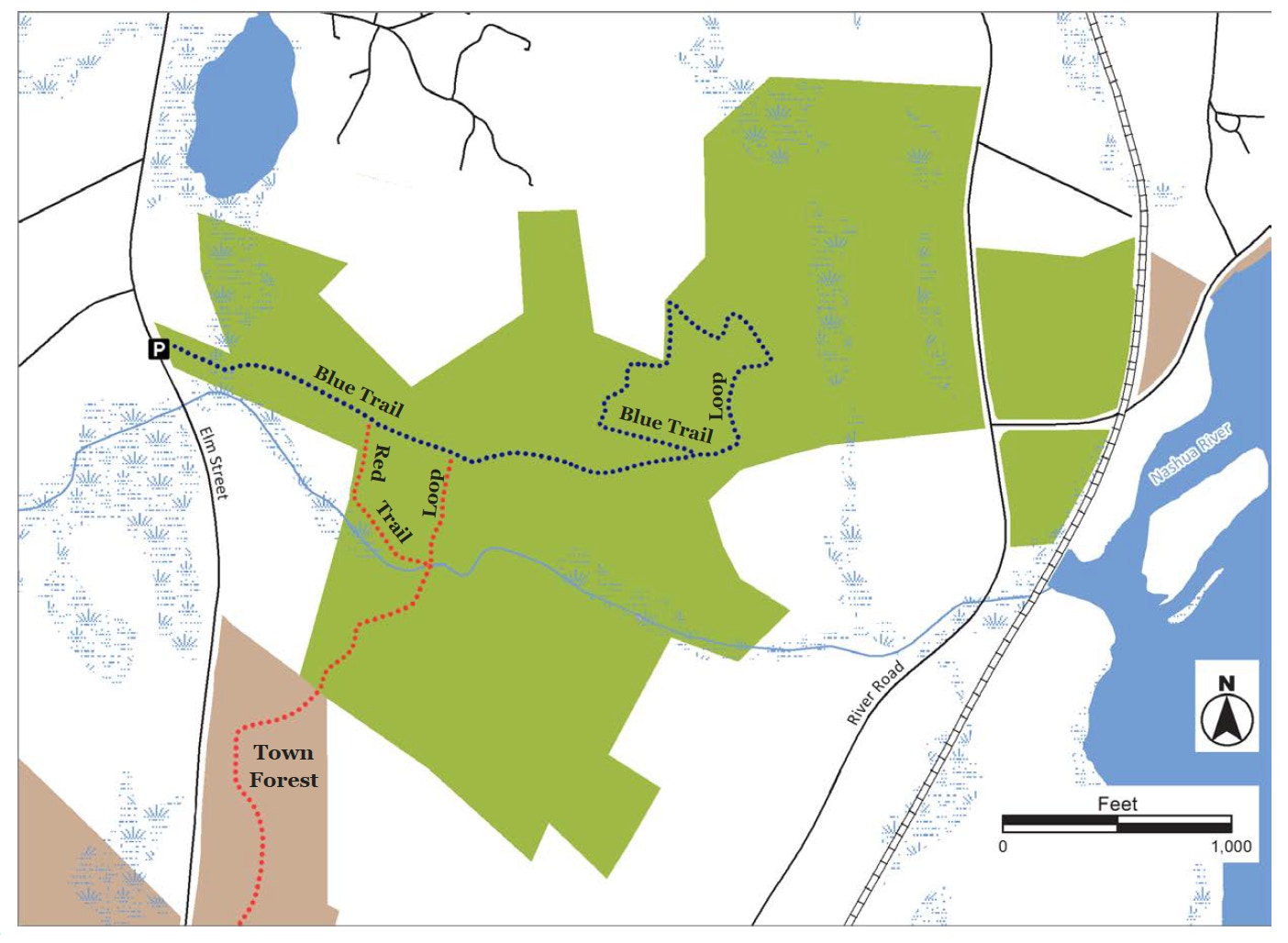
Keyes Farm offers a diversity of forest, field and wetland habitats and a great network of trails to enjoy. Woodlands, riparian areas, and fields create rich habitat for a variety of wildlife. The farmland provides a spectacular scenic approach to the town center from the south and important agricultural land for the community. It abuts the 90-acre Town Forest and another 40 acres of town conservation land on Elm Street making it ideal for longer hikes.
Land Protection History
George and Lucy Keyes were ardent conservationists who donated and helped protect hundreds of acres of land in Pepperell and surrounding towns. George Keyes was a founding member of NCT and donated a 39-acre conservation restriction on his property in 1987. The Trust for Public Lands (TPL), Nashoba Conservation Trust and the Town of Pepperell worked with the Keyes Family to protect 145 acres of farmland and forest. TPL purchased the property and transferred ownership of 106 acres of forestland and farmland to NCT and the remaining 39 acres of forestland to the town.
Trail Description
Keyes Farm has two main trails, both of which are designated with color-coded T.O.P trail markers: (1) Blue Trail. The Blue Trail winds through a small wetland with American hornbeam trees and continues through a mixed forest of beech, maples and
oaks. At .45 miles, the trail turns left and goes up a hill to a private driveway. Cross the driveway and look for trail markers in the white pine forest (the driveway is private property and only can be crossed to follow the trail. Please do not walk up or down the driveway). The trail continues around a field and, after crossing the driveway again, returns to the main Blue Trail. (2) Red Trail. Starting from the parking area, the Red Trail starts with a right turn off the Blue Trail and follows a stream to a bridge. Arriving at the bridge turn left and return to the Blue Trail.
Trail Mileage
From the parking area the Blue Trail to the start of the Blue Trail Loop is .45 miles; the Loop adds .48 miles. The Red Trail Loop is .43 miles.
Directions
From Pepperell Town Hall, follow Elm St. past Shirley St. to gravel parking area on left. The trailhead is behind the kiosk. The GPS coordinates for the parking area are: Latitude 42.657445; Longitude -71.597513
Click map to enlarge
All rights reserved. All content on this site property of Nashoba Conservation Trust.
Do not copy or reproduce in any form for any reason without written permission from Nashoba Conservation Trust.