
Nashoba
Conservation
Trust

Nashoba
Conservation
Trust
Pepperell Springs
Hiking through Gulf Brook Ravine is like hiking through a
remote, rocky section of the White Mountains in New Hampshire. The ravine is a fault line known as the Wekepeke Fault that runs from Worcester MA to NH. Steep, rocky ledges rise up on either side of Gulf Brook which flows through the moist, rocky ravine. The Jeff Smith Trail follows the edge of the ravine offering fantastic views of the brook and gorge. Pepperell Springs abuts Heald Pond to the south and connects to Gulf Brook to the north.
Land Protection History
Pepperell Springs was formerly a spring water source for the
Pepperell Spring Water Company, started in 1893. Protecting this 265-acre property was truly a community effort. NCT, the Town of Pepperell, The Trust for Public Lands, the Nissitissit River Land Trust and the Nashua River Watershed Association collaborated on the project. Many months of organizing and fundraising came to fruition at a Special Town Meeting in September 2004 where Pepperell residents voted to purchase the land. The land is now owned by the Pepperell Conservation Commission with a conservation restriction held by the Division of Fisheries and Wildlife.
Trail Description
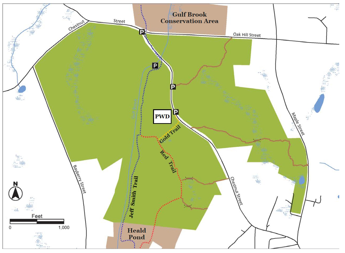
This is a description of a loop trail combining the Gold, Red and Jeff Smith Trails. The Red and Gold trails are marked with color-coded T.O.P. trail markers; the Jeff Smith Trail (JST) is marked with blue paint hashes. From the parking area opposite the Pepperell Water Division (PWD) building, cross over to and up the PWD driveway to the Gold Trail entrance. At .14 miles the Gold Trail terminates at the Red Trail. Turning left the Red Trail continues through a mixed forest with large tracts of mountain laurel. The trail crosses into the Heald Pond property, and at .71 miles intersects with the JST. Turn sharply right and follow the JST enjoying views of the ravine and Gulf Brook below. At 1.30 miles the trail descends into a small clearing and intersects with the Red Trail. Turn right to rejoin the Red Trail and head back to the parking area via the Gold Trail. Alternately, you can continue on the JST to Chestnut Street and walk up the road to the parking area. Please take note: portions of the Jeff Smith Trail trail are on a high ridge with a steep drop-off.
Trail Mileage
The Gold Trail/Red Trail/Jeff Smith Trail loop is 1.5 miles out from and back to the parking area.
Directions
From Pepperell Town Hall, head north to Park St and left onto Heald St. Go 1 mile then right onto Maple St. at intersection of Maple and Chestnut take left onto Chestnut. Follow Chestnut for .5 miles to gravel road. Park across from the Pepperell Water Division building and walk down road to the Jeff Smith trailhead, or cross the street to access the Gold Trail. The GPS coordinates for the parking area are: Latitude 42.68135; Longitude -71.63048. You can also head north on the Jeff Smith Trail from Heald Street (see the Heald Pond map for details).
Click map to enlarge
All rights reserved. All content on this site property of Nashoba Conservation Trust.
Do not copy or reproduce in any form for any reason without written permission from Nashoba Conservation Trust.