
Nashoba
Conservation
Trust

Nashoba
Conservation
Trust
Blood Brook Ravine
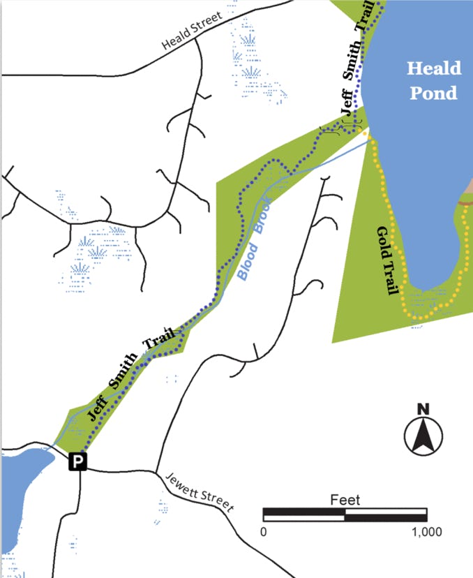
The trail head on Jewett Street marks the start of the 7.2 mile (one-way) Jeff Smith Trail (see Map 17). This narrow, 10-acre strip follows the Wekepeke fault line and is notable for a massive rock face, which hikers pass below, and a beautiful view of Heald Pond at the trail’s terminus. The well-canopied forest of oak, maple, beech and hemlock is complemented by an understory rich in ferns and woody shrubs, such as Hobblebush and American bladder- nut. Wildflowers, ranging from the subtle pink of the Herb-Robert to the vibrant yellow of the Marsh marigold, can be found in the parcel’s diverse habitat. Blood Brook Ravine abuts the Heald Pond Conservation Area to the north.
Land Protection History
The Pepperell Conservation Commission acquired 10.26 acres of land from James Bryanos in 1981. The Blood Brook Ravine parcel acquisition continued a decades-long effort by the Pepperell Conservation Commission and NCT to protect the Gulf Brook watershed and drinking water supply, and to create contiguous wildlife habitats.
Trail Description
The trail starts along the eastern side of Blood Brook and crosses at .24 miles to the western bank. From there the trail climbs up and along a ridge and then descends down to the brook once again. At about .35 miles the trail passes along a massive, 100 foot high rock face and then enters a forested area for the final descent to Heald Pond. Options at this point are to return to the trail head, continue on the Jeff Smith Trail along the western shore of Heald Pond or take the Gold Trail along Heald Pond’s southern shore (see Heald Pond map for details). Please take note: This trail has steep slopes and portions can be wet year-round.
Trail Mileage
From the Jeff Smith Trailhead to the intersection with the Gold Trail at Heald Pond is .58 miles.
Directions
From Pepperell Town Hall, head west on Townsend St./Rte 113. At .5 miles turn right onto Willow St. then turn immediately onto Jewett St. Travel approximately 2 miles and there will be a small parking area on the right marking the start of the Jeff Smith Trail. The GPS coordinates for this area are Latitude 42.6638; Longitude -71.6425.
Click map to enlarge
All rights reserved. All content on this site property of Nashoba Conservation Trust.
Do not copy or reproduce in any form for any reason without written permission from Nashoba Conservation Trust.