
Nashoba
Conservation
Trust

Nashoba
Conservation
Trust
Day Woods Conservation Area self guided natural history walk
Pat Rice: plant ecologist looking for an excuse to be outside

Spring is progressing -- some plants are already done flowering and others are just starting. The trees are leafing out. I still want to get out and see the changes, and enjoy our trails and nature in town. I’m using the hope that other people would like to know what’s going on with the plants along our trails to get out on them myself. I’ve tied orange flags to particular plants (or sometimes near them) with the names on them and sometimes some natural history observations. Because the flags are picking up on time sensitive points such as flowers or early leaves I’ll leave the flags out for about 2 weeks, then remove them from any given trail. Please leave the flags there, I really will pick them up (and reuse them). The trails and plants will still be there after the flags are removed (well, some of the invasives will get clipped). Mostly I will be noting seasonal changes of our native plants. But, I’ll also note some of the invasive plants with comments on their effects on the native plant communities.
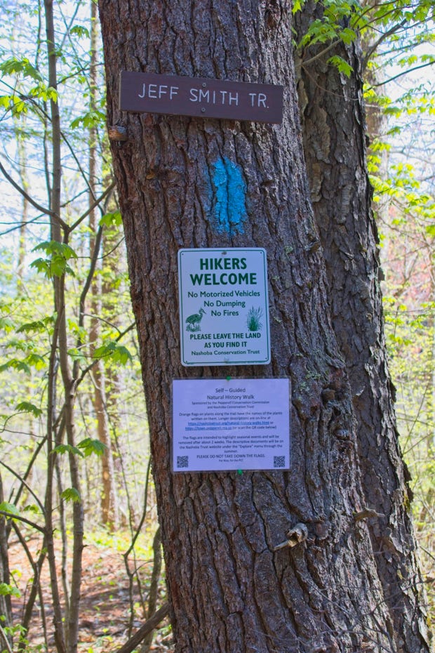
Blue paint dots, Jeff Smith Trail
flagging May 7-24(ish) to the north and a short stub east to the stream
Parking
From Pepperell Town Hall, follow Park St. north about 1 mile. Bear left onto Oak Hill St and follow for 1.3 miles. Turn right onto Lawrence St. and continue another 1.3 miles. Look for the wooden sign for Day Woods Nashoba Conservation Trust on the right. Park off the road near the sign. The GPS coordinates for the parking area are: Latitude 42.69637; Latitude -71.63613.
https://nashobatrust.org/trail-guide.html
www.town.pepperell.ma.us/trails
General observations:
Please do not walk in the mud or wet areas, that creates a lot of disturbance.
Ticks: Just be careful to check yourself after a walk. Spraying insecticide on your clothes can deter them, but check anyway.
Black flies: Are out. Again insecticide on clothing and hats discourages them, but they’re there and active.
Poison Ivy: The oils are present year around, don’t grab the branches, roots or stems. Wash with a good soap after exposure.
Flagging:
I put up flagging in the parking area, past the chain link fence. and along the main trail past the bench overlooking the of the wetland to a trail stub that goes east (right) to Gulf Brook. If you want a longer walk, the blue marked Jeff Smith Trail continues north onto the town’s Bemis Road Conservation Area (map #7 in the trails guide), still white pine oak hemlock forest, and then just into New Hampshire where an old rail road bed, the Potanipo Rail Trail. The state line is marked by a line of yellow paint on the trees. If you go east on the rail bed, you’ll very shortly encounter a bridge over Gulf Brook with a lovely view of a long beaver dam to the south, lots of wetland plants, and the stream flowing north to the Nissitissit River. The rail trail connects to trails on the Bemis Conservation land off of Bemis Road. There are different plants in different areas, look around as you go!
The parking area is in white pine hemlock dominated forest.
1: White pines (5 needles per group, soft looking) are the largest trees here. These will be the first trees that started to reforest the land after open land was abandoned in the past. The forest will change in the coming years as the white pines get older, die, and fall - and they are replaced by the trees now in the understory, oaks, maples, and hemlocks. Large white pines with side branches indicate that they grew in the sun. As the forest closed in, the side branches were shaded and allowed to die as the trees grew taller, putting their energy into growing branches and needles in the sun.
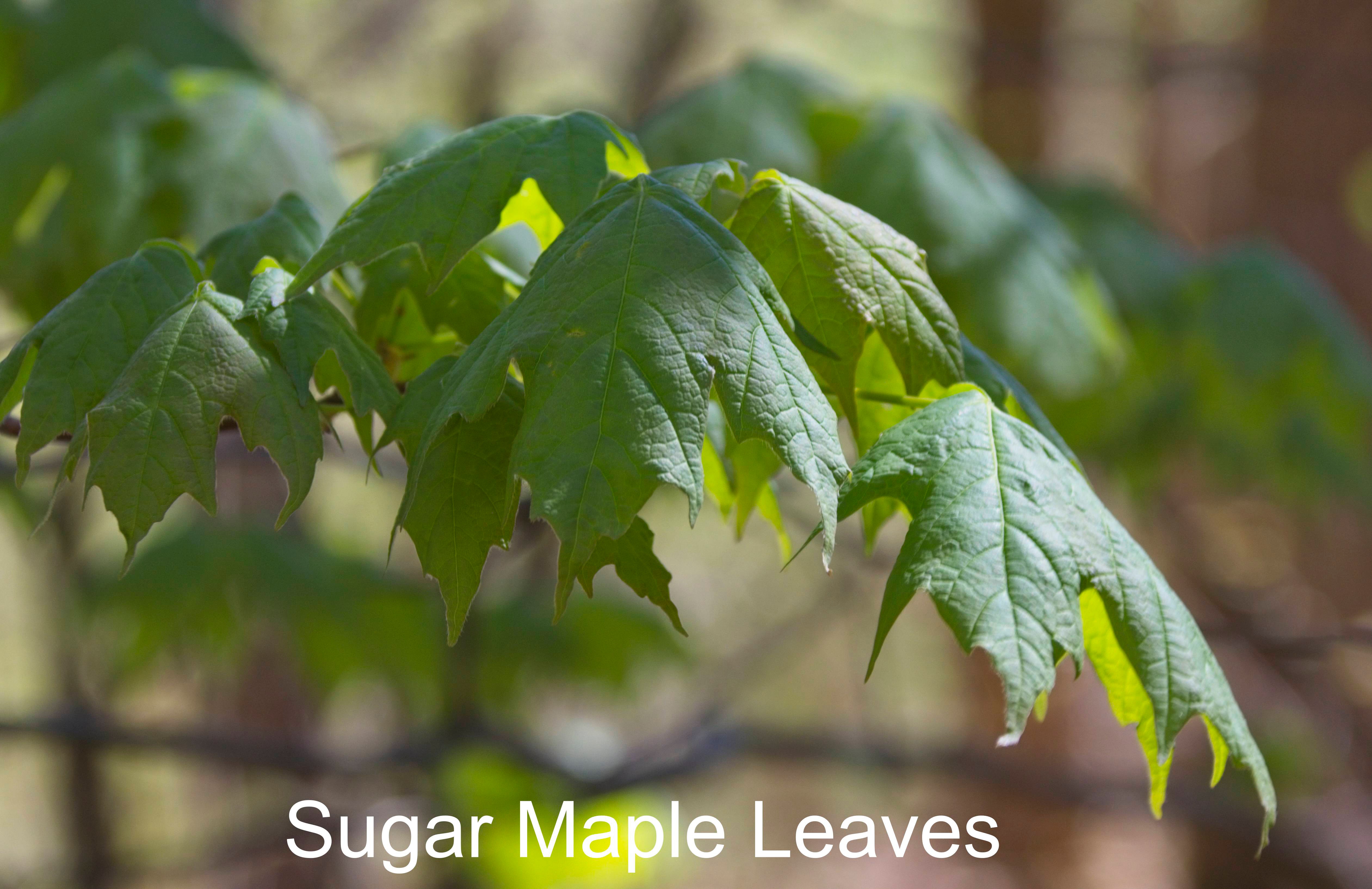
2: A sugar maple sapling may represent the future of the forest. Sugar maples are able to survive in relative shade and grow quickly in the sun to replace older trees that fall down.
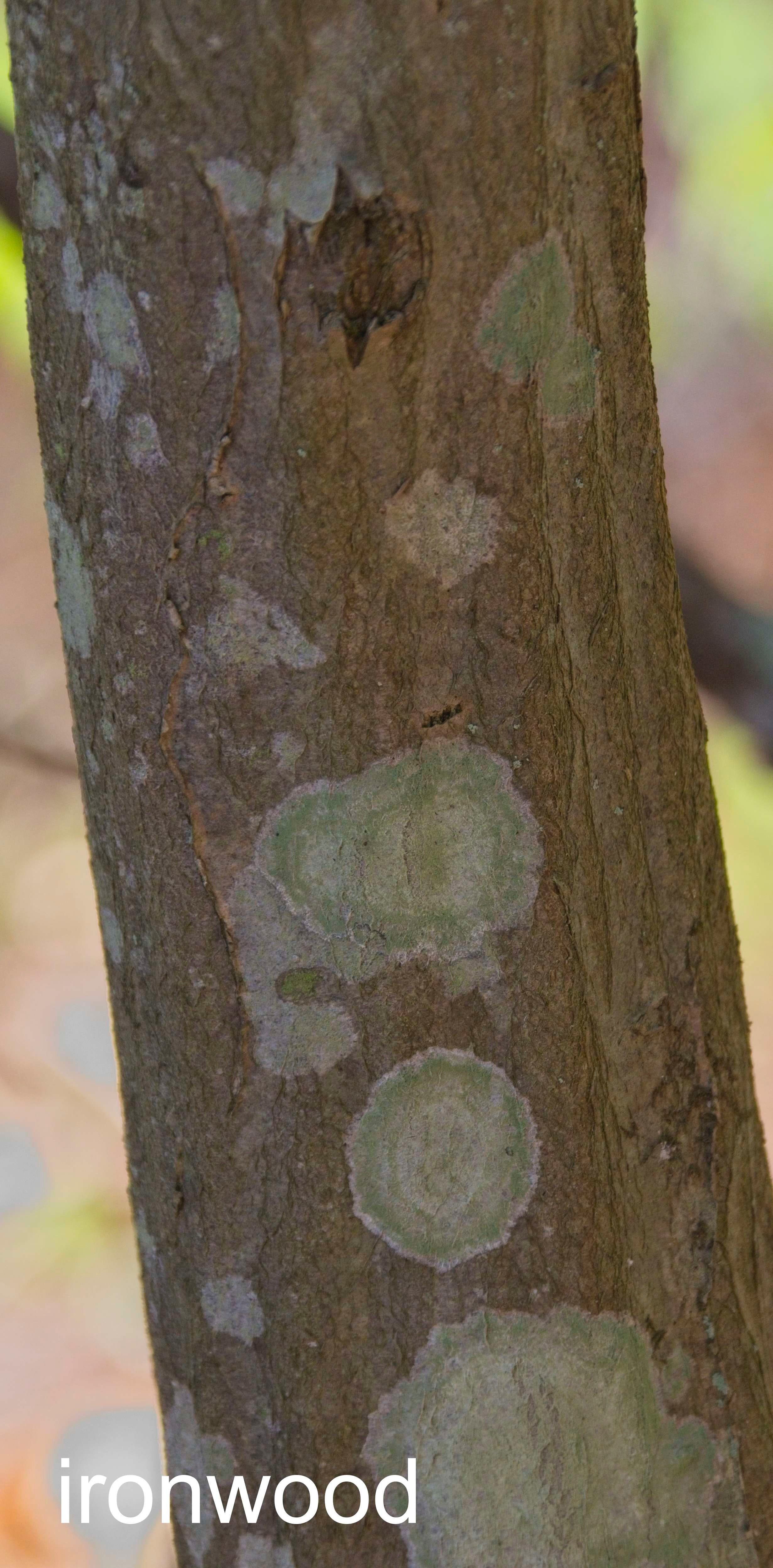
3: The trail is near the wetland, which is both wet and sunnier than the closed forest. Shrubs such as the flagged ironwood (Carpinus caroliniana, also called hornbeam, blue beech and musclewood) do better with more sun, and in the case of ironwood, damp soils. They are in the birch family and their catkins released pollen into the air. As you walk the trail, look for some quite large ironwoods with their distinctive bark texture that can be imagined to be muscles under the skin.
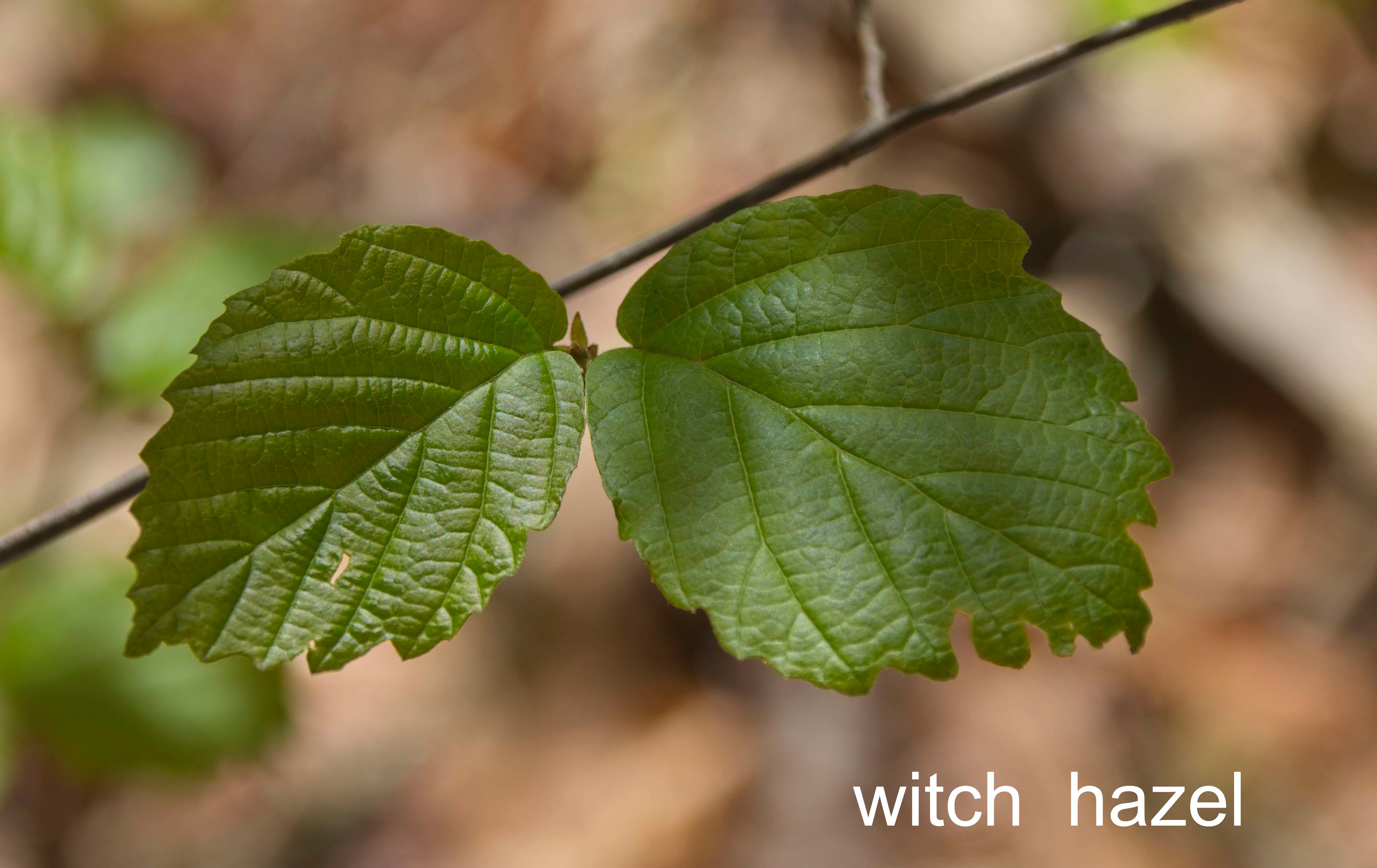
4: Witch hazels, with their not-quite paired asymmetrical leaves were just leafing out when we put flags out. Witch hazel is often found in damp forests, under the partial shade of a tree canopy, but not in dense shade. Look for witch hazel flowers in the fall.
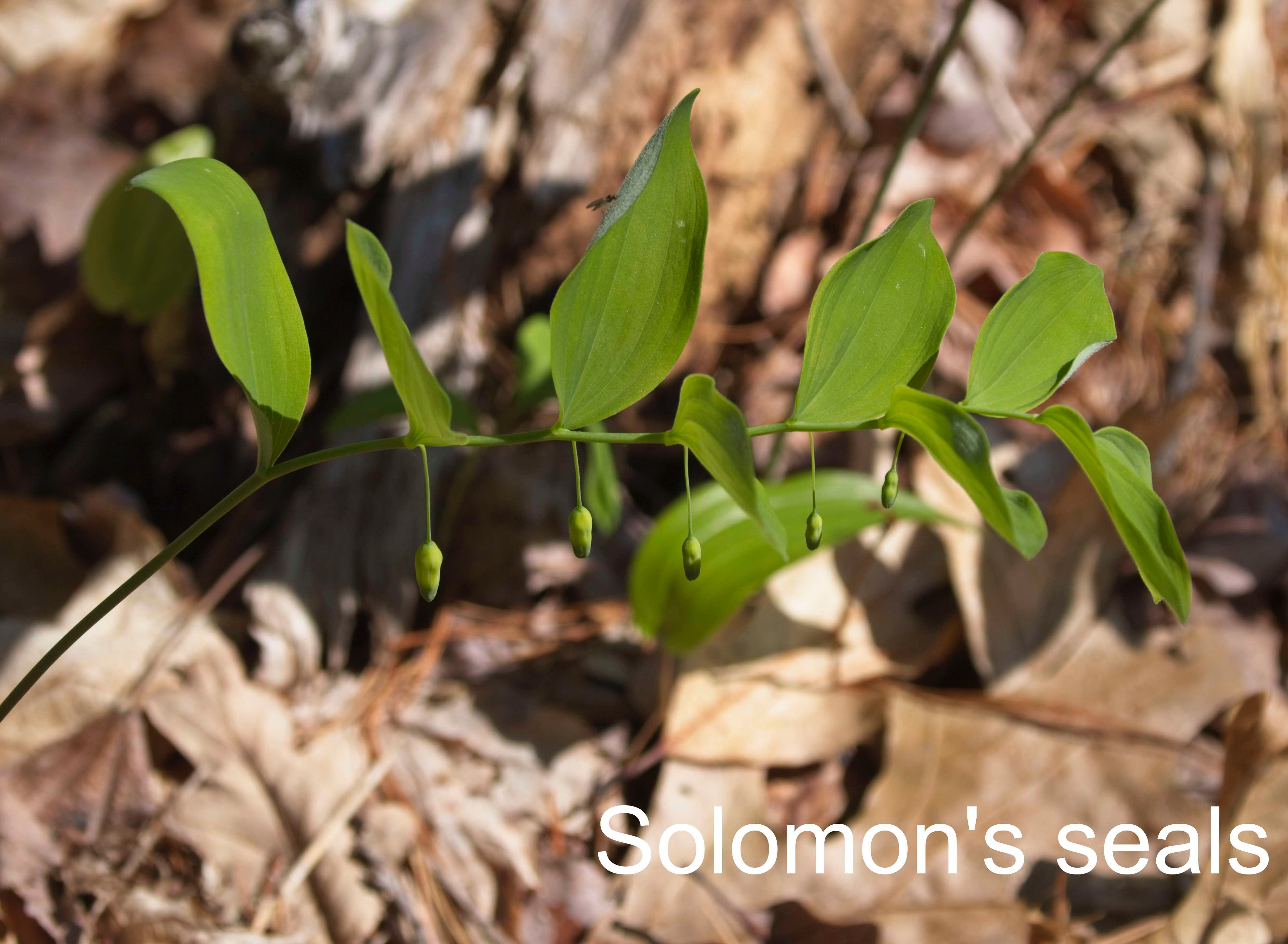
5: Many plants on the forest floor are emerging and becoming identifiable, particularly along the trail where there is more light than under evergreen trees. Solomon’s seals were in bud when flagged, these buds will be whitish-greenish flowers before long.
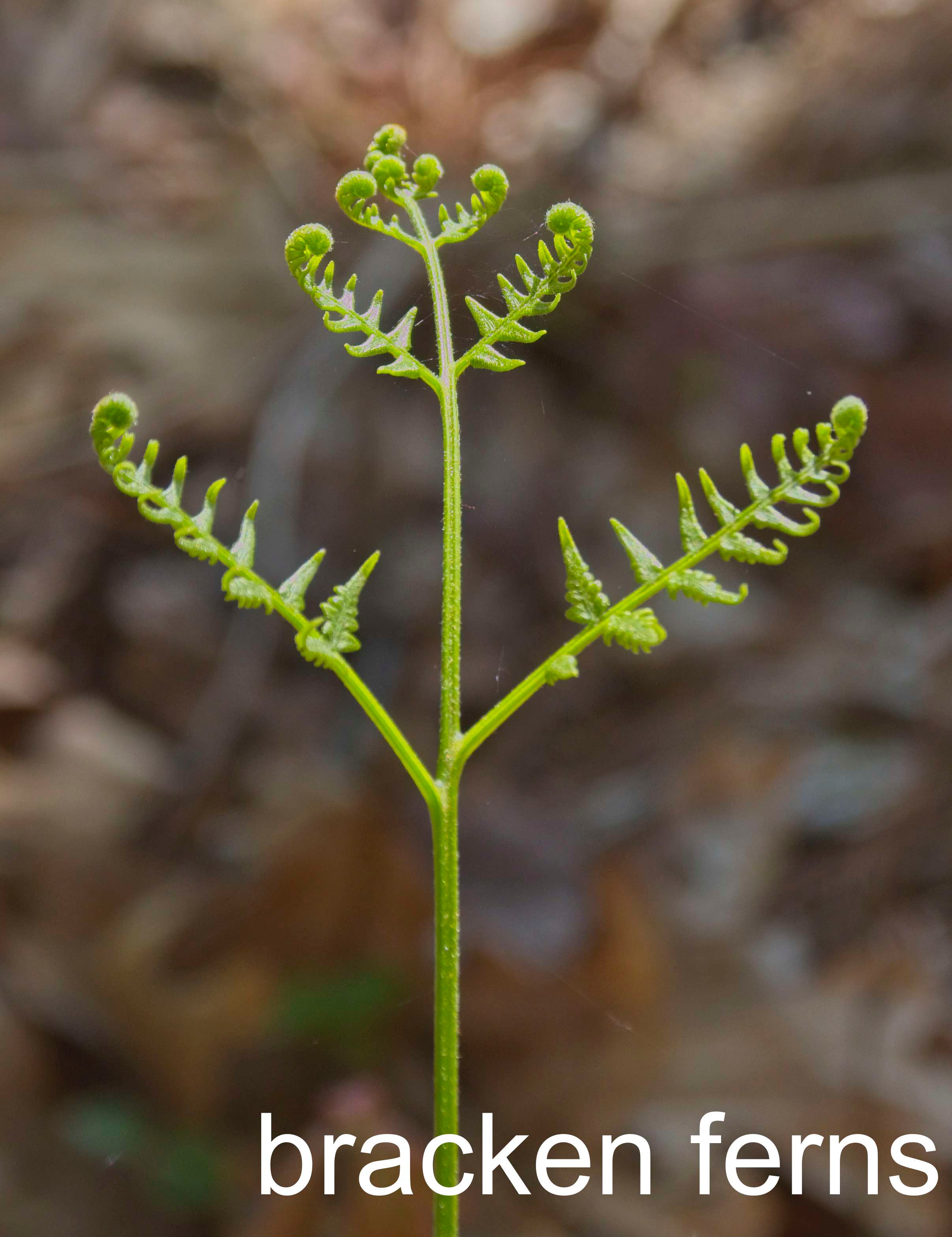
6: Bracken ferns are unfurling their distinctive 3-parted leaves.
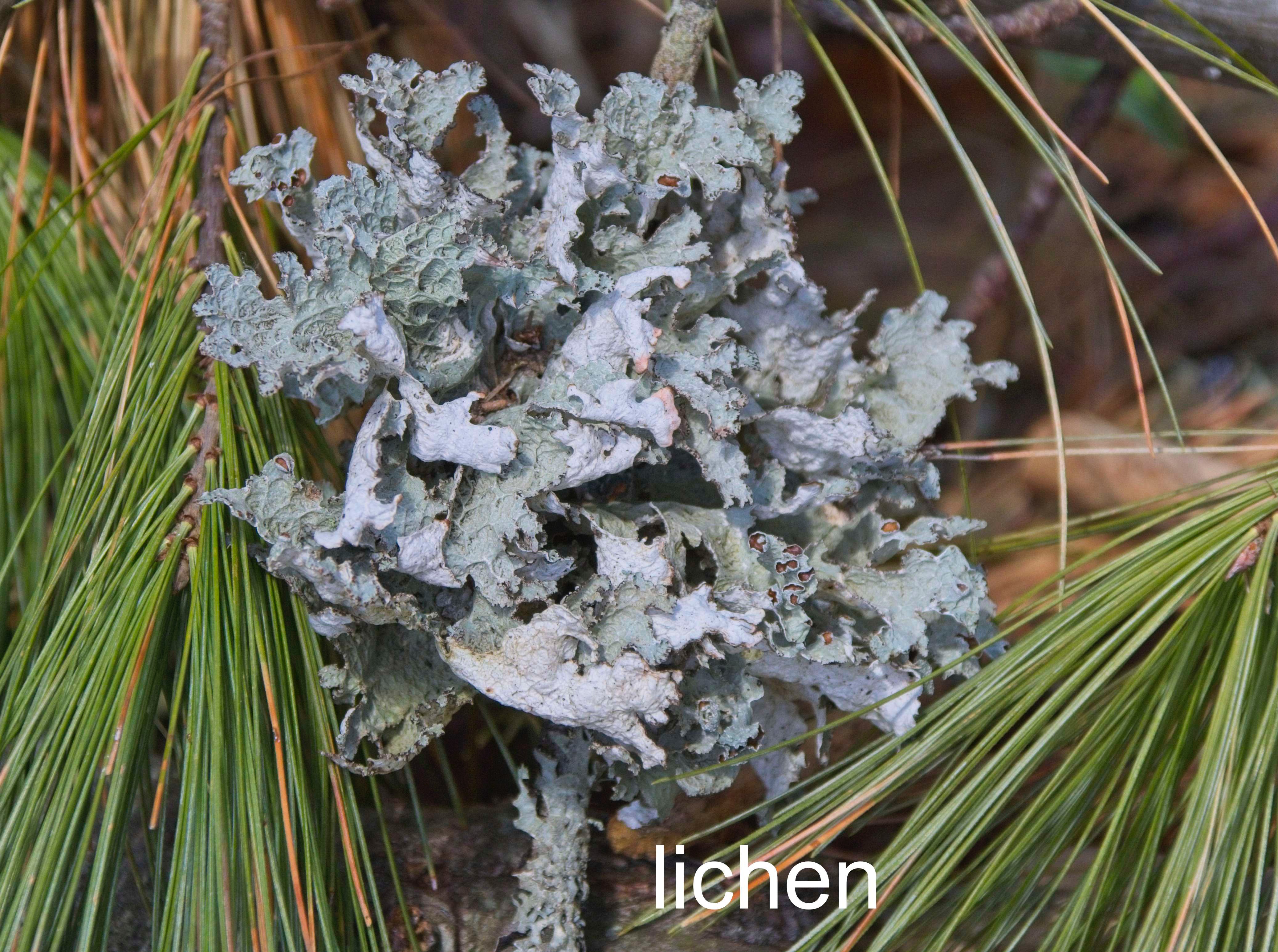
7: Lichens on branches fallen from the tops of trees. These are ‘foliose’ – leaflike – lichens. Lichens are very sensitive to air pollution, the presence of lichens on so many of our trees indicates good air quality in Pepperell.
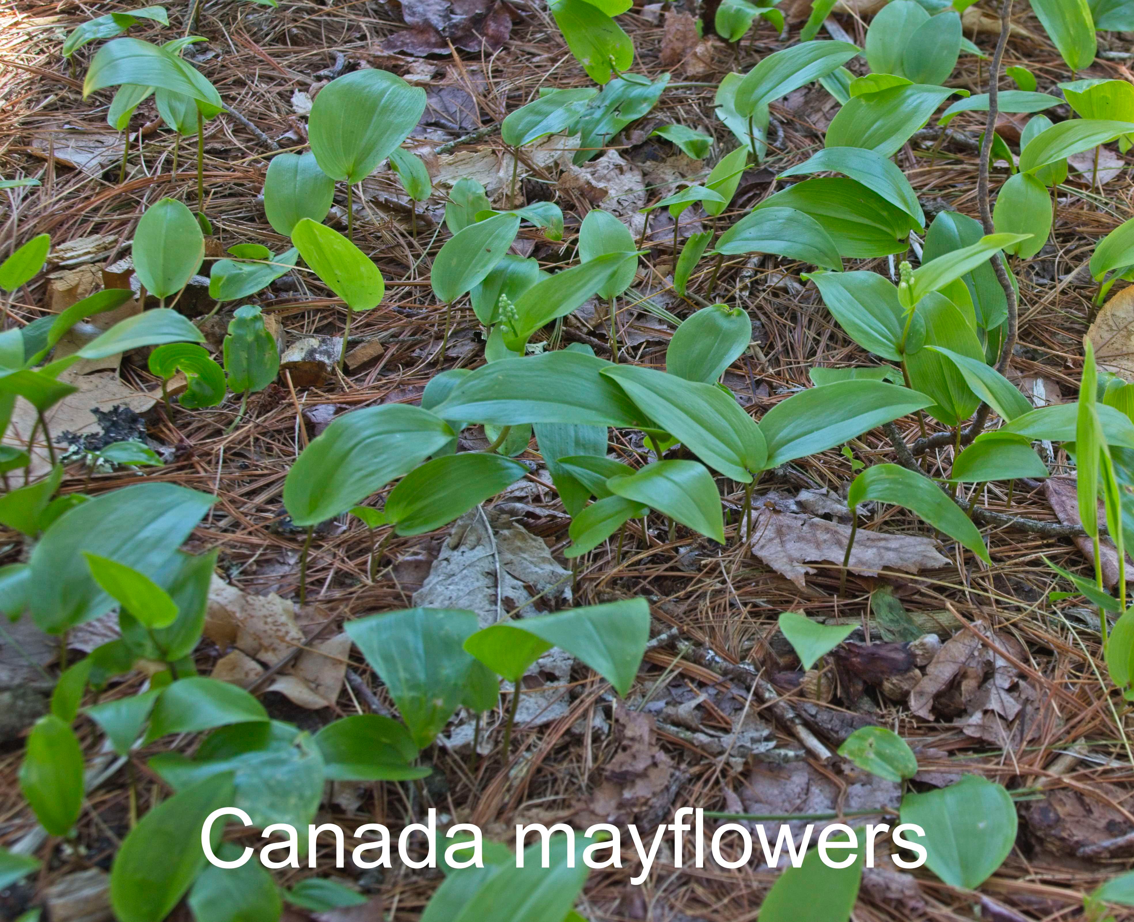
8: By the bench and scattered along the trail and in the forest are small and large patches of Canada mayflowers, mostly just single leaves. Plants with more than one leaf have put up clusters of buds, soon to be clusters of white flowers.
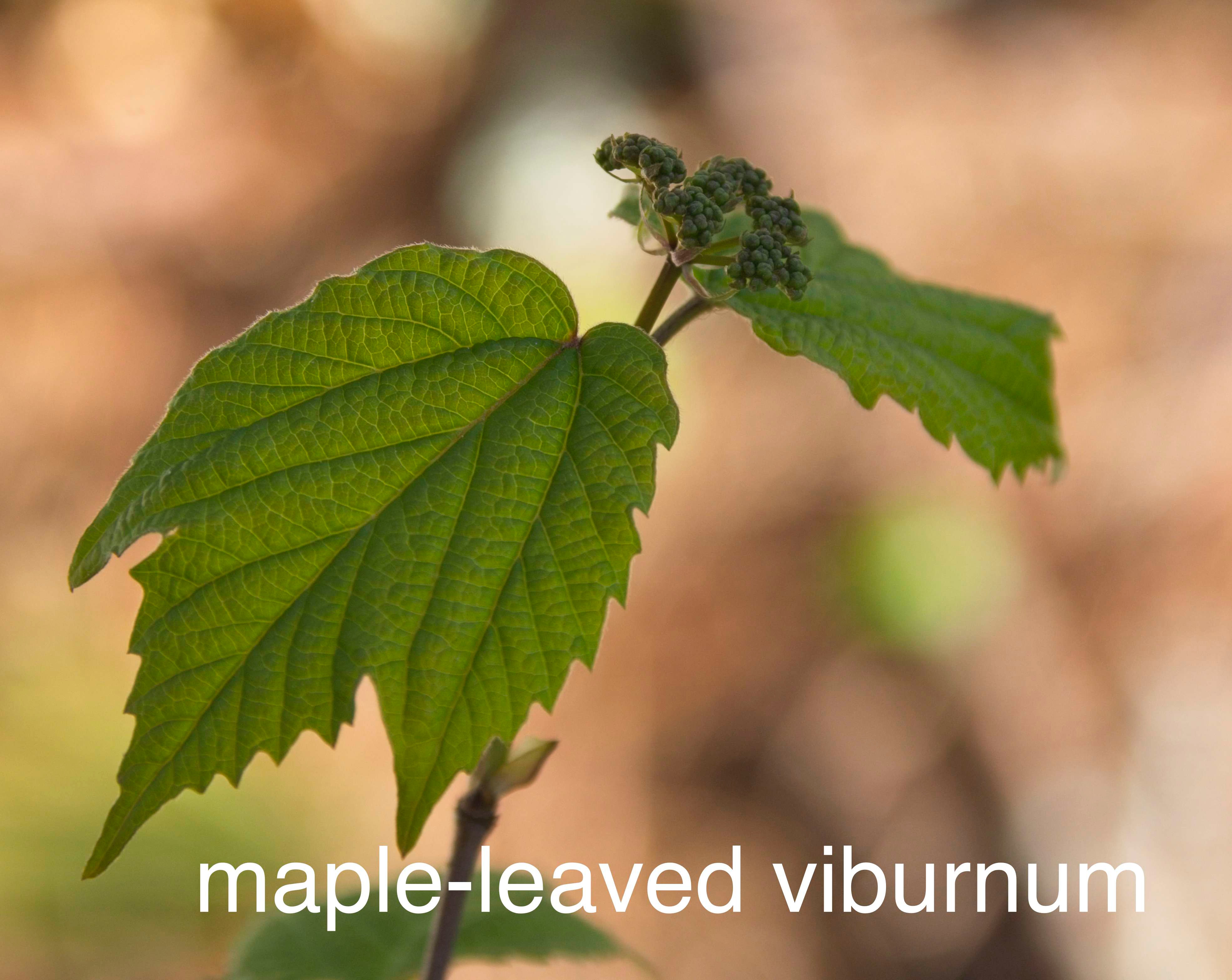
9: Also in the area of the bench are maple-leaved viburnums, these low shrubs have paired leaves and a flat cluster of white flowers that later will produce dark purple fruits.
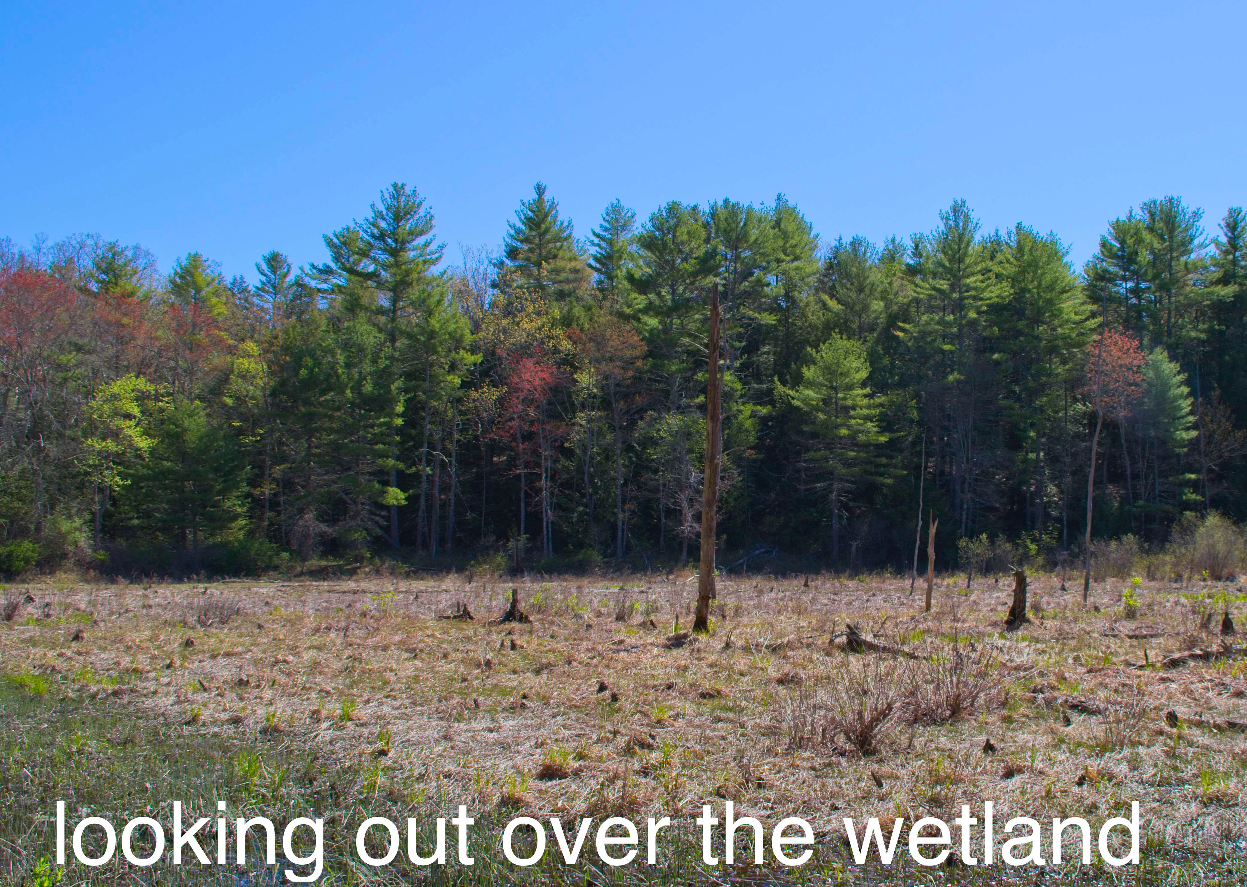
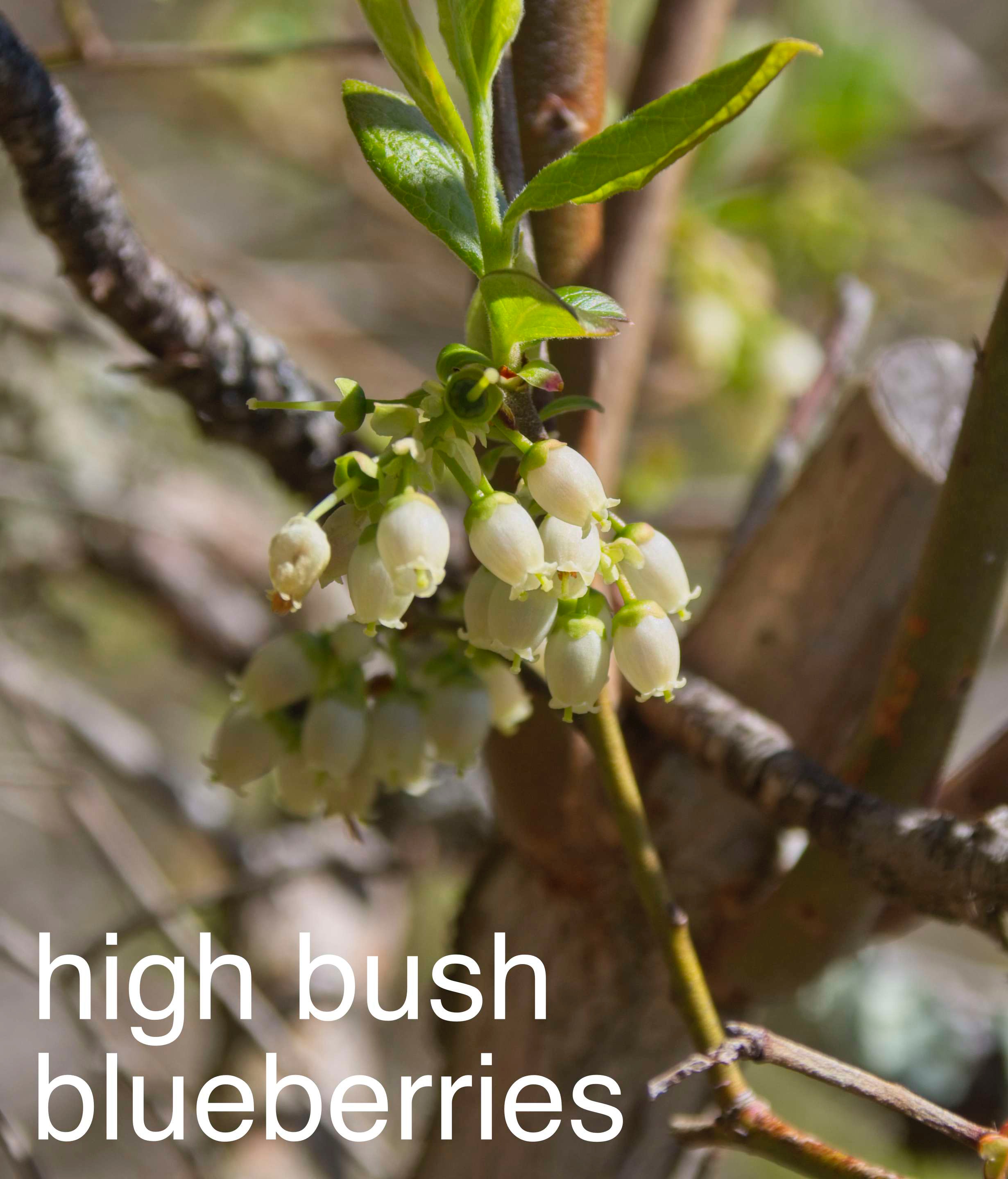
10: Not flagged as such! At the bench take time to look out over the wetland and notice patches of red maple marked by their abundant red seeds. White pines are the yellow-ish green trees with soft fairly flat tops. Hemlocks are darker green, in this view, generally shorter than the white pines. There are also hemlocks along the trail. Right at the edge of the wetland are shrubs with very dense clusters of whitish tubular flowers – look for these high bush blueberries later on to produce berries, favorites of birds as well as people.
11: Nashoba Conservation Trust has been working on this area, removing a non-functional dam from the stream and making this part of the trail accessible. You can read about that project on the NCT website here: https://nashobatrust.org/gulfbrookdam.html This construction will become much less visible as the plants fill in.
12: Note that the hemlocks here don’t have the invasive insect, Hemlock Wooly Adelgid (no white cottony attachments to the branches). Note the new growth on the hemlock branch, doing well in this site. Hemlocks have short, single needles with lighter stripes on the backs. The white pines have 5 long needles in each group, and look (and are) soft.
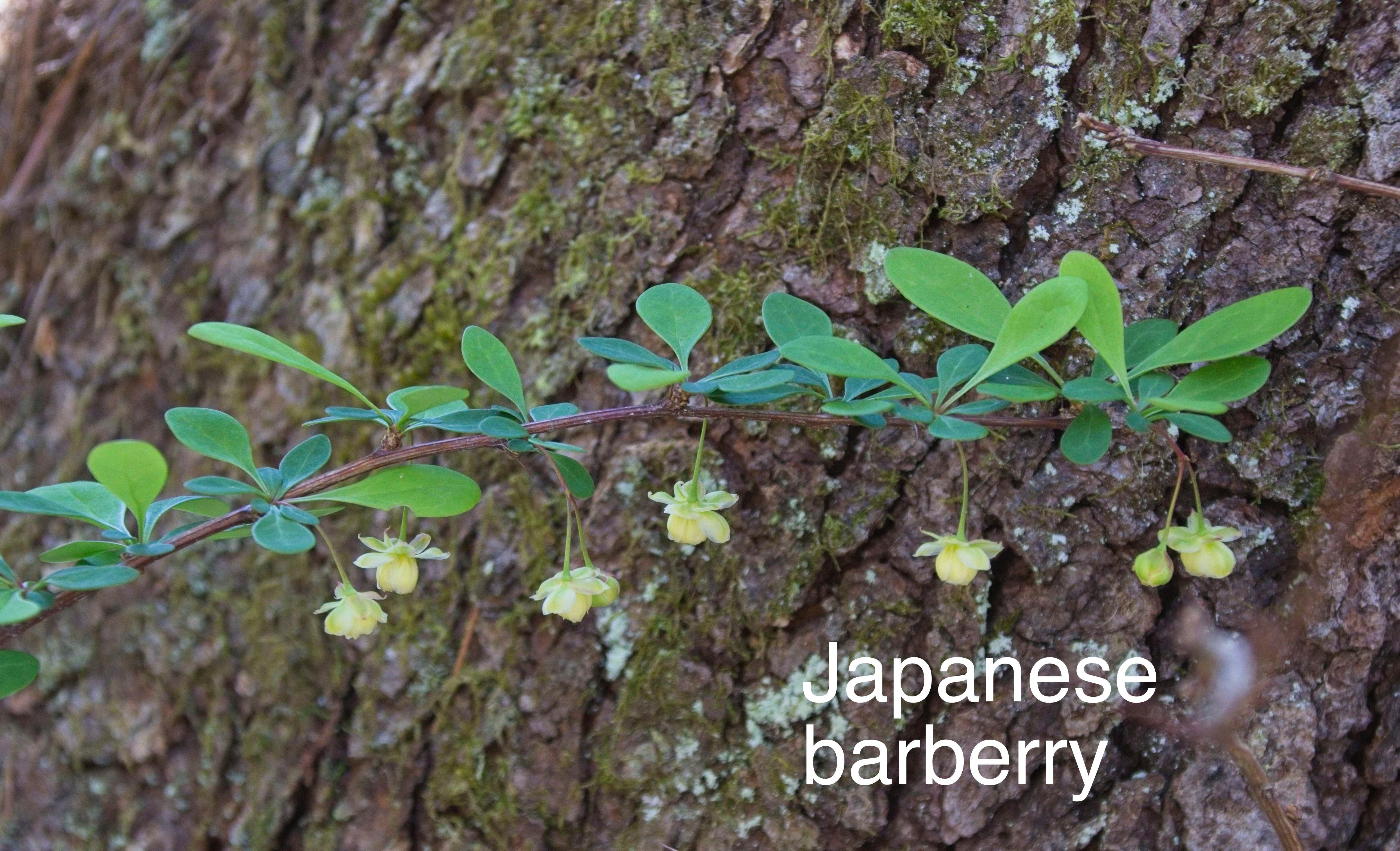
13: Places that have had soil disturbance in the past often now have invasive plants that are quick to take advantage of sun and lack of competition. This area that years ago was disturbed now includes invasives in the mix of plants. Japanese barberries are low shrubs now leafing out and flowering. Because the seeds are easily spread to new areas, these will be cut off when I remove the flagging.
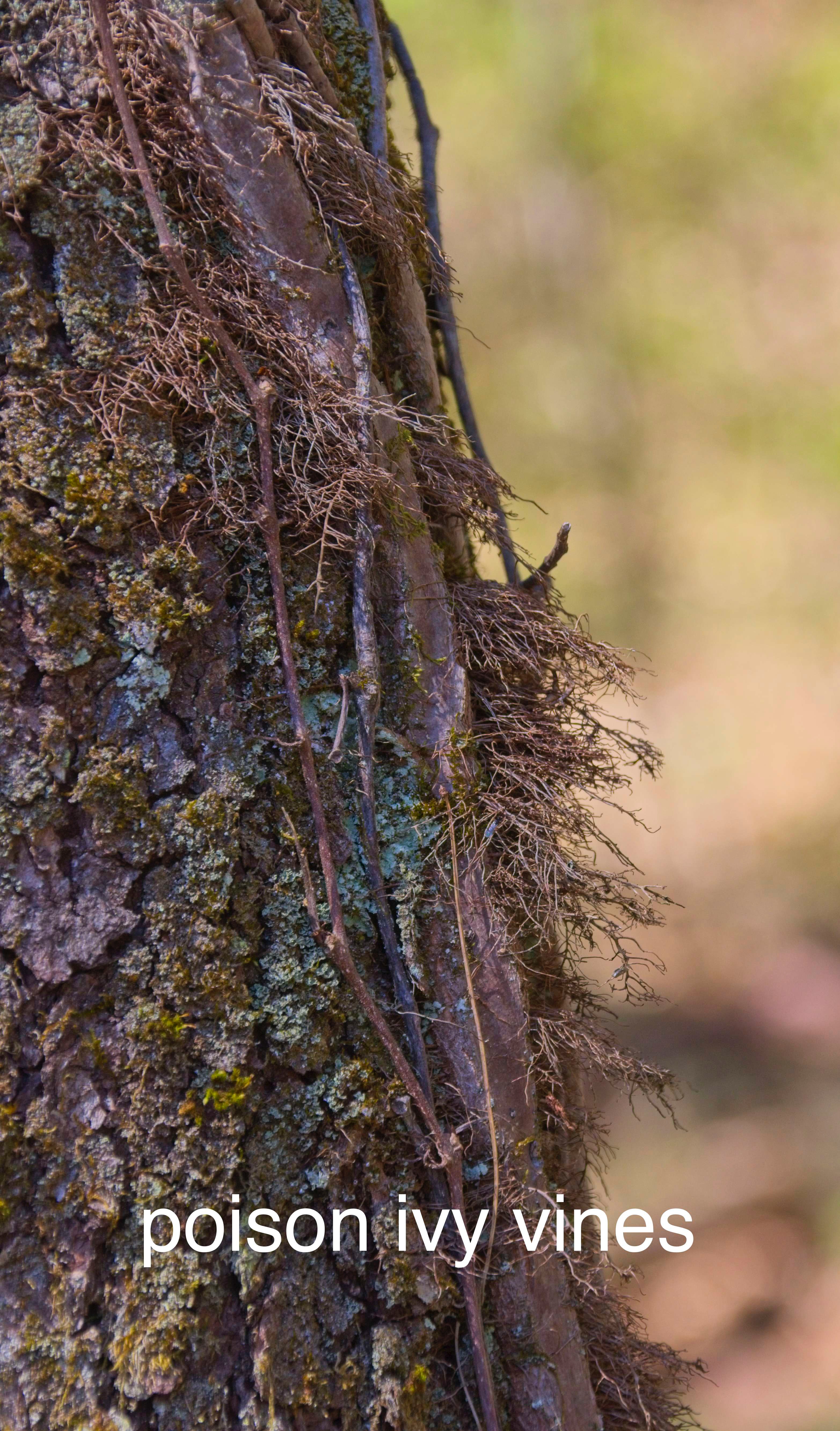
14: Above the barberry, on the trunk of the native black cherry tree, there are vines. Some of the vines look hairy, as the roots attach to the tree trunk. These are poison ivy, a native species, with white fruits in the fall that are good bird food.
Continue north for a short distance, look for flags on the trail to the east (right). The path to the east is a short stub that goes to the stream and some different plants.
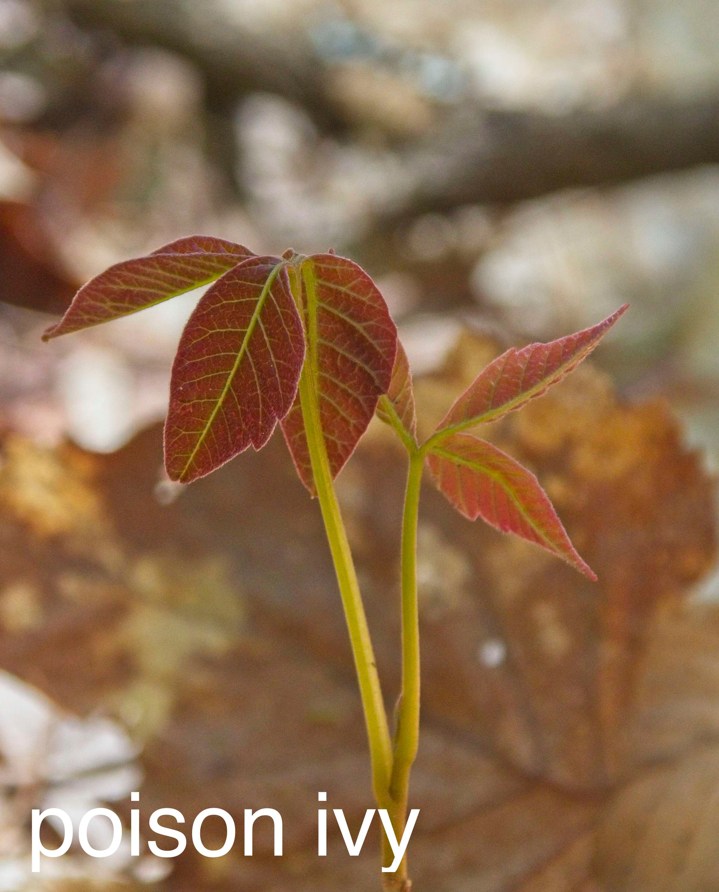
15: At the path intersection, there are some more poison ivy plants, these not growing up trees. The shiny red leaflets are distinctive for now (they’ll turn green before long), but many other plants have reddish leaves in the spring.
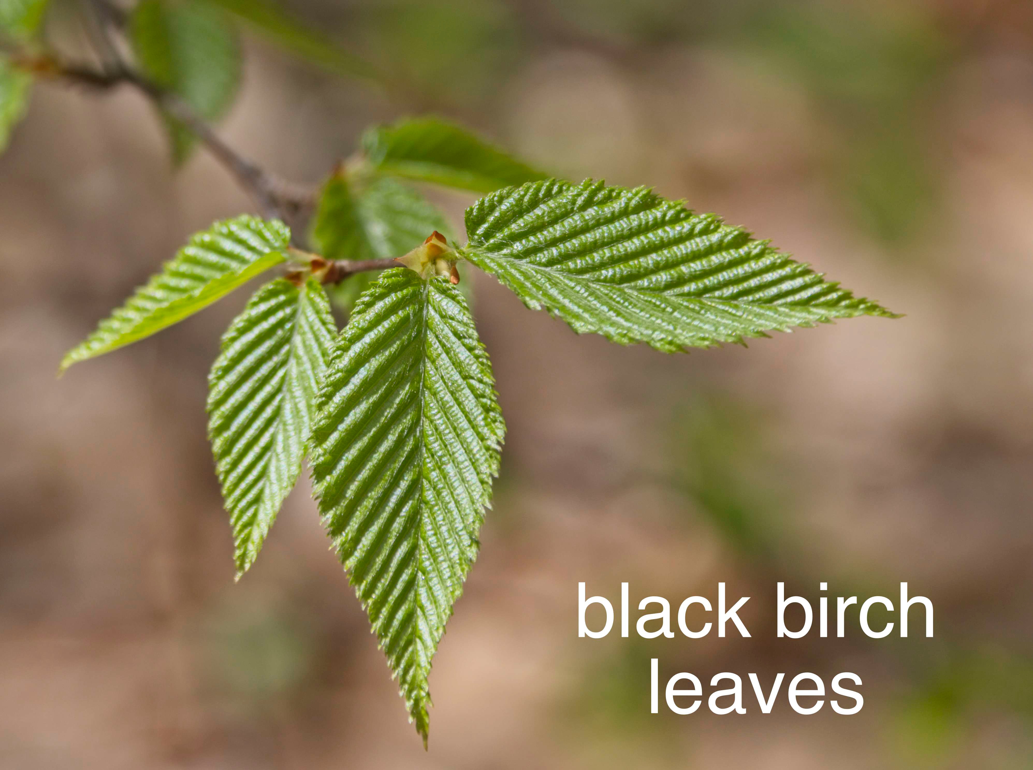
16: Black birch are trees of young forests, they don’t reproduce well in shade, so become fewer in older forests. Black birch have a wintergreen odor to their inner bark (so do yellow birch, but not other local birches).
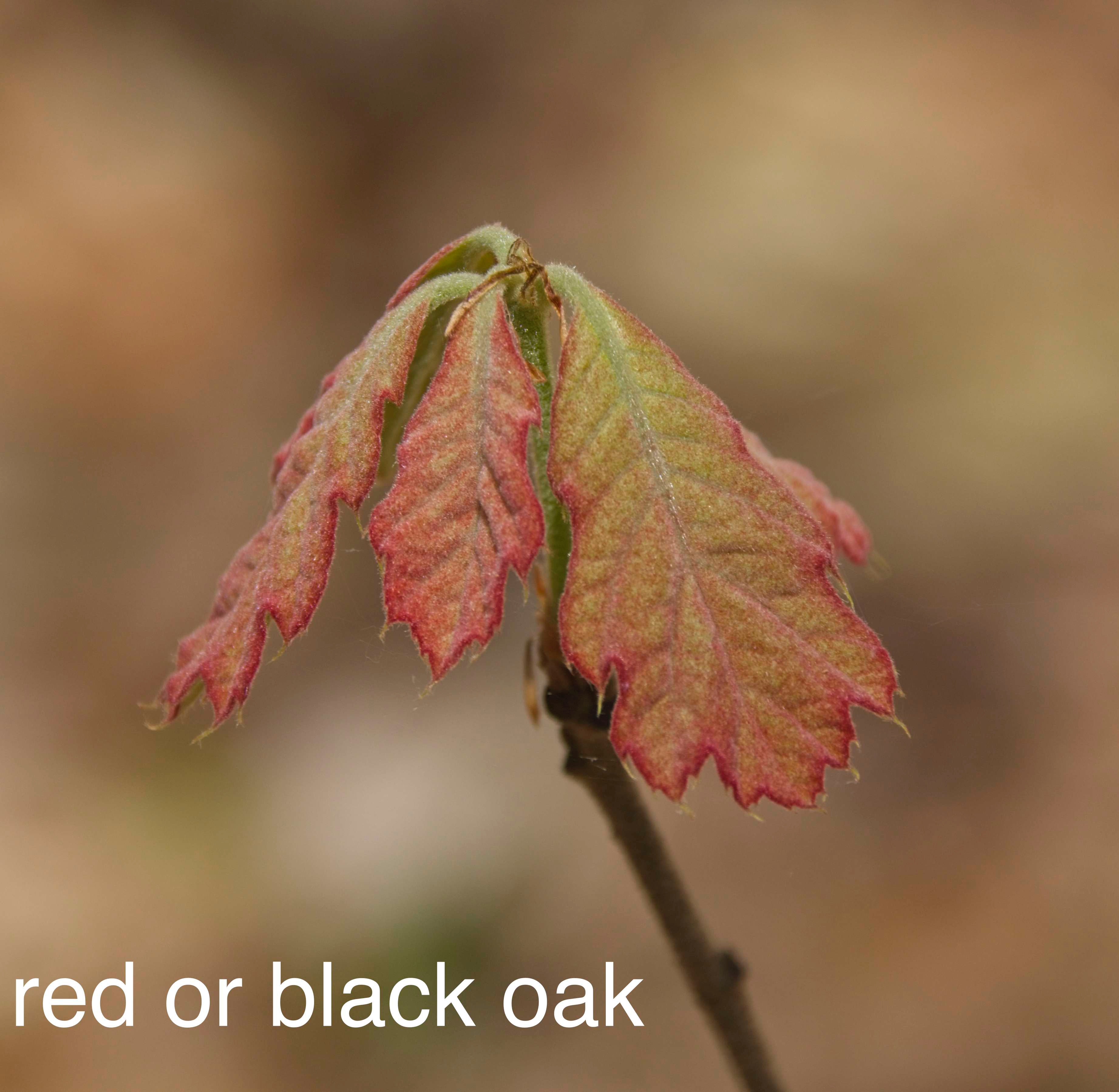
17: There are oak saplings along the trail edge. I tagged a small oak as ‘red or black’ oak (and you might see under that magic marker it says ‘white oak’). Spring leaves are hard to tell apart as they emerge! White oaks are present here, but this plant has leaves with bristle tips, which are found on the red/black oak group, not the white oaks.
18: I have no idea why there is a chain around the base of this pitch pine tree – probably not to keep it from running away. Maybe an old gate? Pitch pines have 3 needles per group. Their thick bark is resistant to fire, and some of their cones only open and drop their seed when a fire has passed (heating the air and melting the resin that seals the cones). So we often see pitch pines in areas that have burned. But we also see pitch pines in boggy areas, on peat (such as near the transfer station on Boynton St.). A plant of challenging habitats.
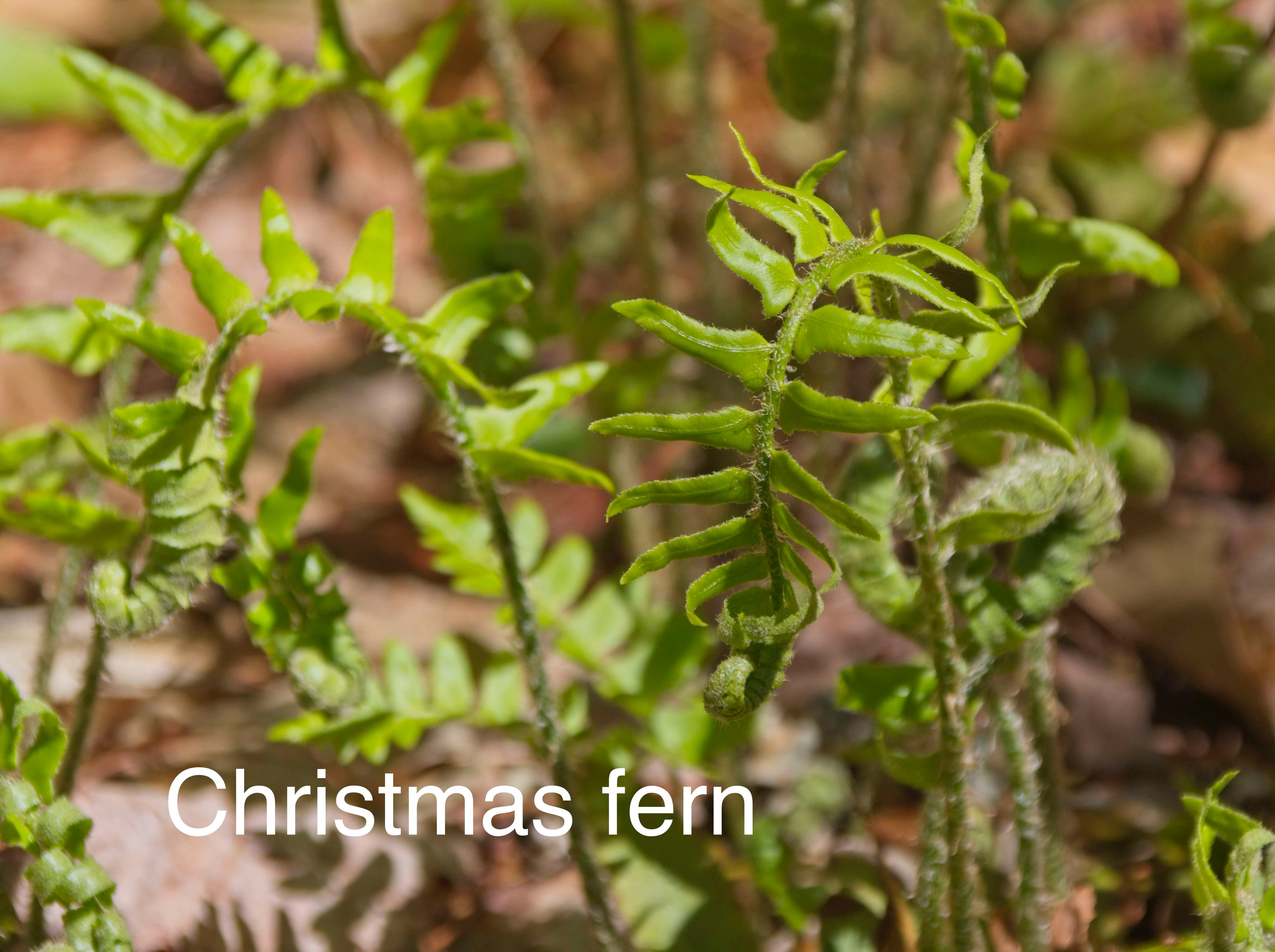
19: Christmas ferns are evergreen, so identifiable all year round. I enjoy seeing them unfurling and looking even more fern-like than usual.
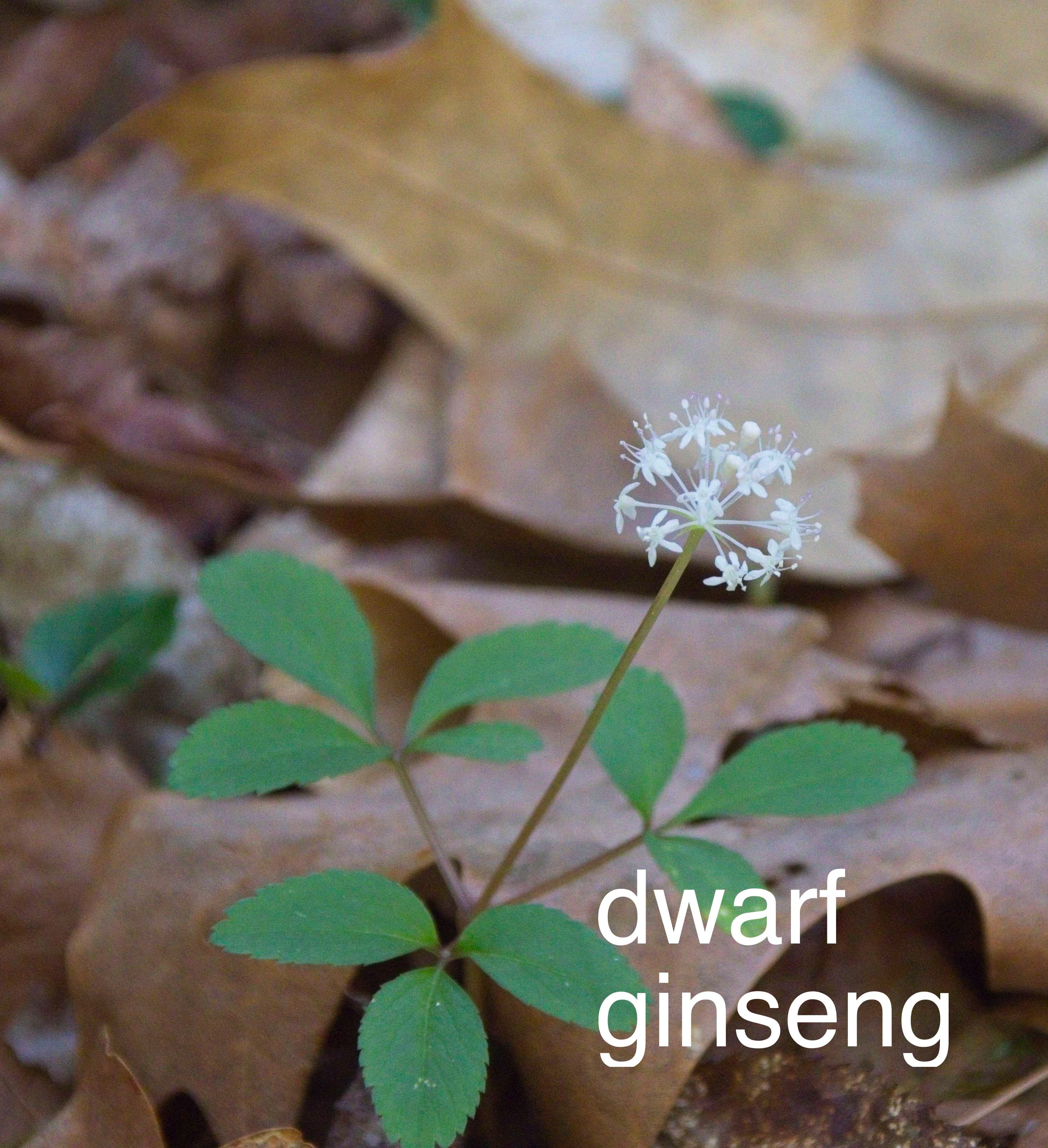
20: The small plant with a ball of white flowers is dwarf ginseng. Near a stream like this is its usual habitat. This is not the medicinal ginseng, but is in the same genus.
This area along the stream gets lots of sun and water and supports a lovely mix of different plants. My notes say, base of black cherry and a large ironwood (hornbeam) there are plants of interest -
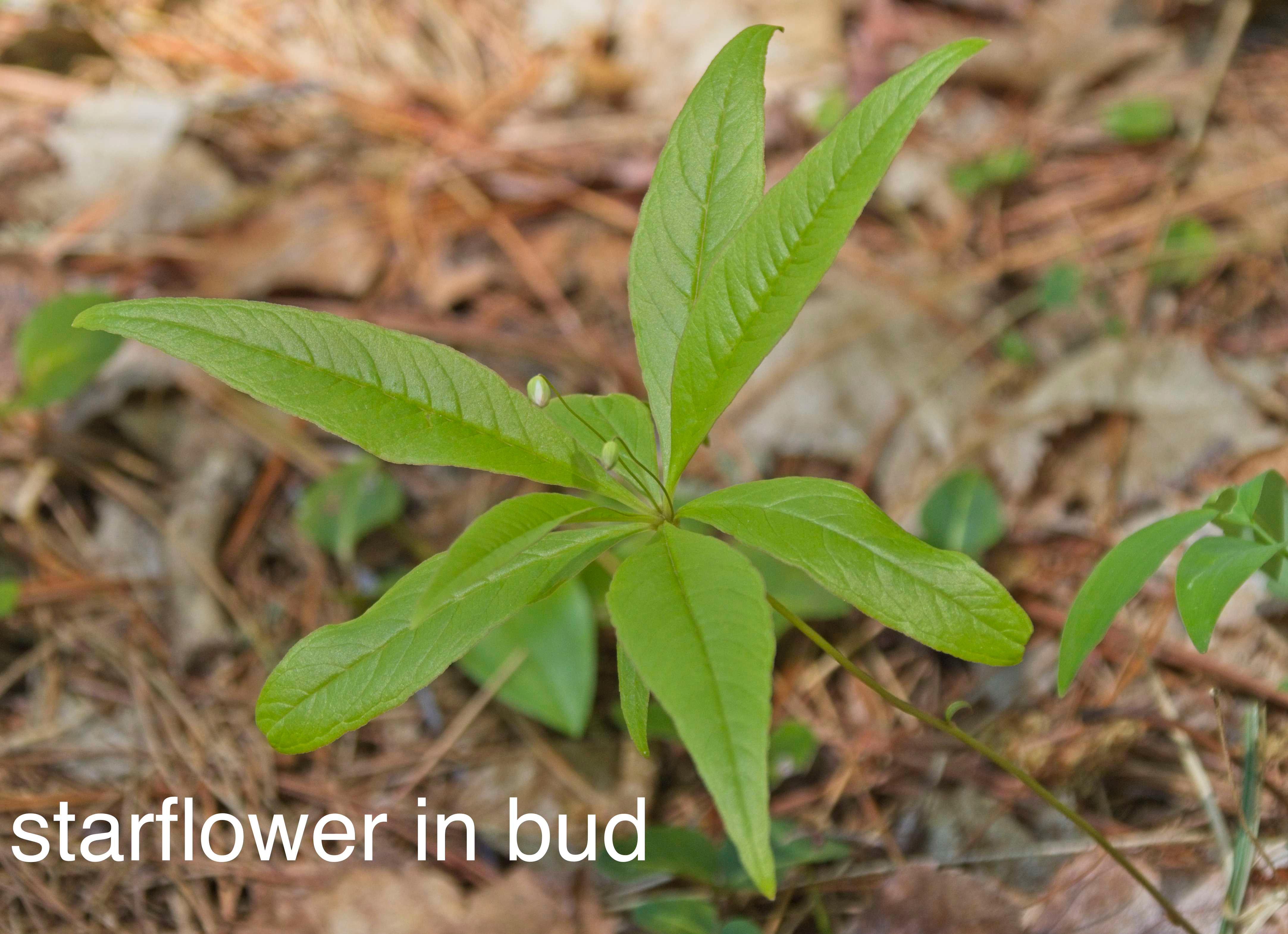
21: Starflower in bud (may well be flowering by the time anyone looks at it.)
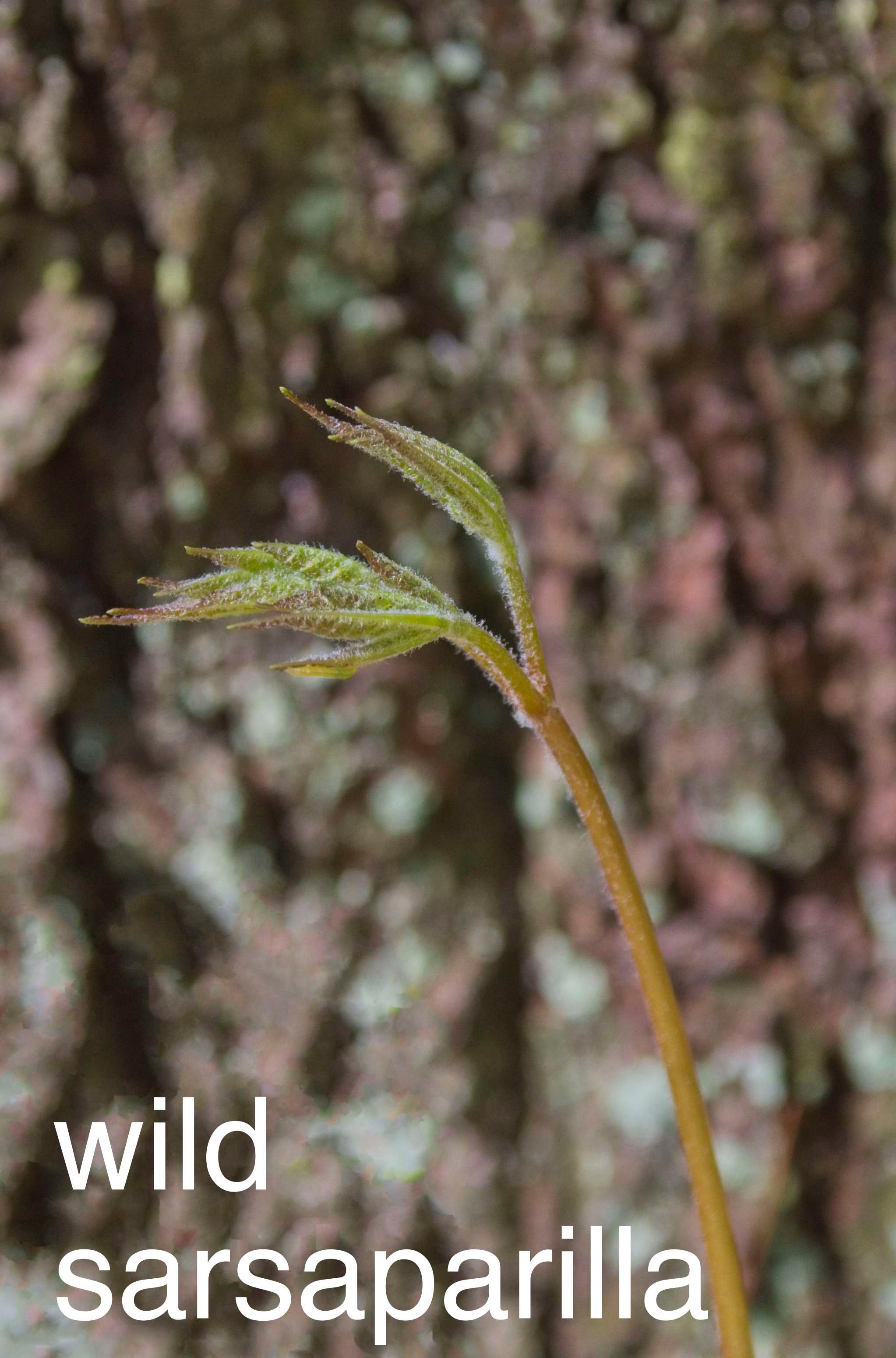
22: Wild sarsaparilla, the tall single compound leaf is above the spherical flowering cluster.
This is as far as I put out flagging on the plants. This trail stops at the water, unless you want to get wet (I don’t know where the trail across the stream goes).
If you have time and interest, there is a pleasant walk if you go back to the main trail and go north instead of back to the parking area. The Jeff Smith Trail continues north through a post-disturbance white pine – oak – hemlock forest. Deciduous trees are mixed in, usually shorter / younger than the white pines, black, red and white oaks, sugar and red maples, and black (platey black bark), yellow (golden curls on the bark), white and gray birches. There are lots of understory plants, fewer (down to essentially nothing under dense hemlock canopy). There are evergreen plants like partridgeberry, wintergreen, and pipsissewa that are identifiable year around. There are large patches of Canada mayflowers with starflowers, lowbush blueberries, and seedlings of forest trees.
Keep to the right, mostly following the blue dots of the Jeff Smith Trail. If you get to the railbed on the north, try turning right to go to a bridge over Gulf Brook described back at the beginning of this description. Right at the intersection are some lovely very short woody plants called gaywings or fringed milkwort. There are light purple violets along the railbed that are different from the darker purple violets along the trail in the woods. I don’t know their names, but they are different – part of the lovely native diversity of the area.
These self guided natural history walks are collaborative efforts.
Pat Rice identifies and flags all the points of interest. Sue Bleiweiss took the photos and is posting the descriptions on line for the Nashoba Conservation Trust. Paula Terrasi posts them for the Pepperell Conservation Commission.

All rights reserved. All content on this site property of Nashoba Conservation Trust.
Do not copy or reproduce in any form for any reason without written permission from Nashoba Conservation Trust.