Nashoba
Conservation
Trust

Nashoba
Conservation
Trust
For links to maps submitted by Kinder Morgan in their September 15 FERC pre-filing, visit nofrackedgasinmass by clicking here
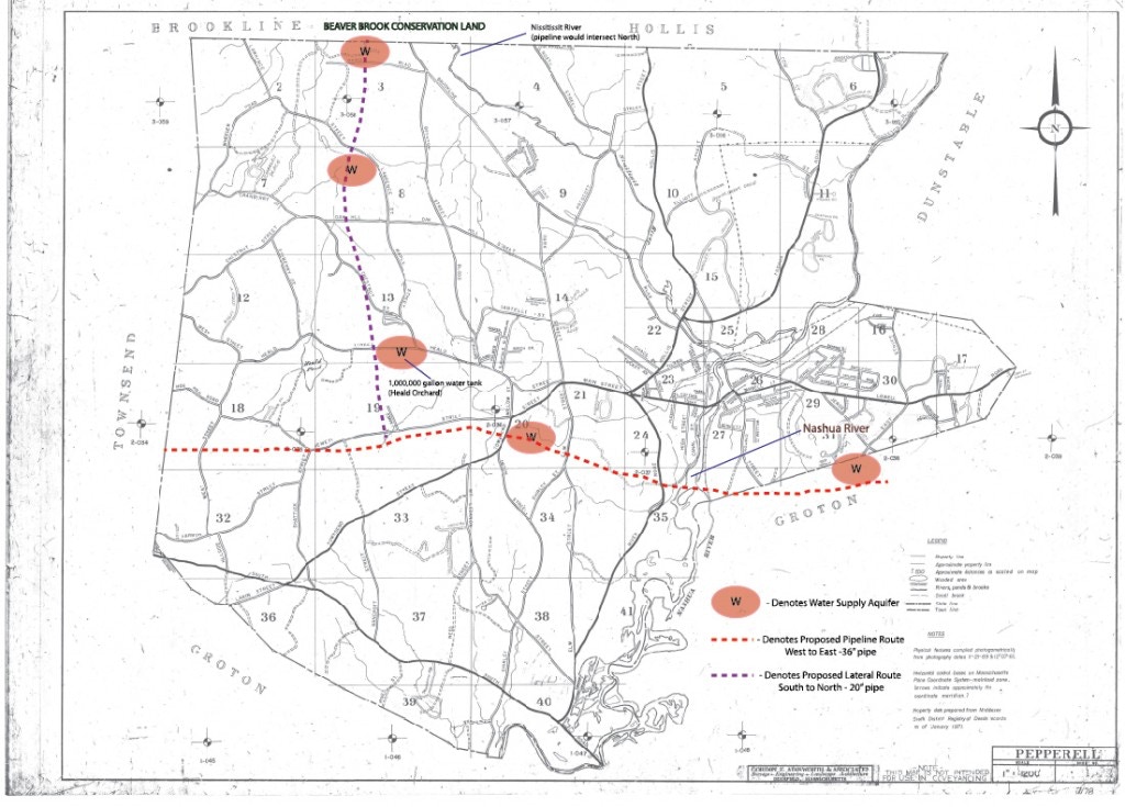
Maps of Pepperell
Scroll Down for additional maps of the entire route and other Local Areas (as well as downloadable PDFs of some)
click maps to enlarge
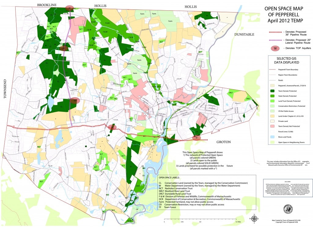
Town of Pepperell - Open Space Map
proposed gas pipeline route
Town of Pepperell proposed gas pipeline route

proposed route - NCT property
Maps of Ashby

Ashby - pipeline proposed route
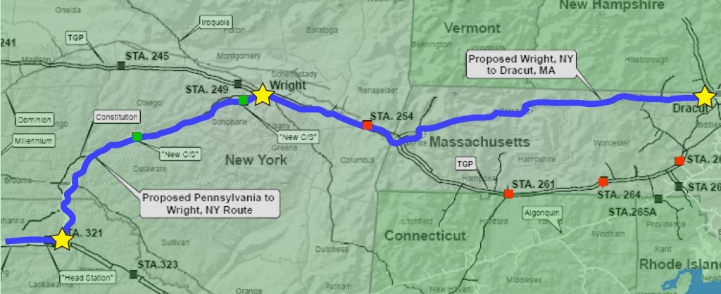
Kinder Morgan Pipeline Route Maps
NED- Northeast Energy Direct Route - May 2014
Additional State-wide Maps

Statewide impacts of Tennessee Gas Pipeline

Kinder Morgan Pipeline Route through Massachusetts waterways
Interactive Maps
Gas Leaks by Grade Level, 2000–2011 – Map of Leaking Gas Lines in Eastern MA
US Pipeline Incidents (2010-2014)
Pipeline Incidents from 1986 to 2013, Relying on Publicly Available Data
Note: The U.S. Dept. of Transportation documents pipeline accidents (‘Incidents’) when one or all of the following occur:
•fatality or injury requiring in-patient hospitalization
•$50,000 or more in total costs, measured in 1984 dollars
• highly volatile liquid releases of 5 barrels or more or other liquid releases of 50 barrels or more
•liquid releases resulting in an unintentional fire or explosion
Downloadable Versions
Town of Pepperell Proposed Gas Pipeline Route – PDF
Town of Pepperell Open Space Map – Proposed Pipeline – PDF
Proposed Pipeline Route Through Keyes Farm – PDF
Pepperell- Groton Border: Map of Tennessee Gas Pipeline Route – PDF
Statewide Impacts of Tennessee Gas Pipeline – PDF
All rights reserved. All content on this site property of Nashoba Conservation Trust.
Do not copy or reproduce in any form for any reason without written permission from Nashoba Conservation Trust.