
Nashoba
Conservation
Trust

Nashoba
Conservation
Trust
We are working to put as much information up as possible about the potential impacts of this pipeline.
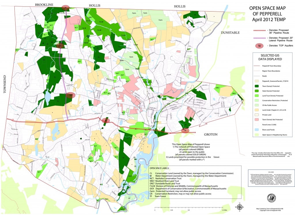
The proposed pipeline would intersect numerous private properties, multiple aquifers, protected wetlands, wildlife habitat and so much more. Residents in all of Pepperell’s neighboring towns of Townsend, Hollis, Brookline, Dunstable and Groton would be impacted by the Tennessee Gas Pipeline installation.
For generations residents have worked to protect the open spaces and the rural character of our towns knowing that for generations beyond us those lands would continue to remain open. The effort to protect land has also been guided by the knowledge that our natural resources are integral to our heath and way of life, so preserving water supplies and the wetlands that feed them has been a priority. In addition to the enormous trenches used to bury the pipe and disruption of the land around them, the use of herbicides and pesticides is a routine maintenance practice once they are in place. According to a Massachusetts Dept. of Environmental Protection Source Water Assessment and Protection (SWAP) Report, The Bemis Road well and two Jersey Street wells are gravel packed wells…”The Zone II for the Jersey Street wells extend into the Town of Groton. Each well has a Zone I of 400 feet. The wells are located in an aquifer with a high vulnerability to contamination due to the absence of hydrogeologic barriers (i.e. clay) that can prevent contaminant migration.”
The U.S. Department of Transportation – Pipeline and Hazardous Materials Safety Administration has an INCIDENT REPORT – GAS DISTRIBUTION SYSTEM (source) form to be filled out in the event of a gas transmission incident. The possible failures include Corrosion Failure (internal and external), Natural Force Damage (including Earth Movement, Heavy Rains/Floods, Lightning, Temperature, High Winds, Other Natural Force Damage), Excavation Damage; Other Outside Force Damage; Pipe, Weld, or Joint Failure; Equipment Failure; Incorrect Operation, and Other Incident Cause.
The ‘Halliburton Loophole’ – In 2005, the Energy Policy Act was overhauled. Among the changes was the addition of what has been called the ‘Halliburton Loophole’, which exempts hydraulic fracturing (the process by which this gas will be obtained) from signifigant EPA regulation. This exemption applies not only to the drilling but also to the storage and transporting of fracked natural gas.
It is impossible not to ask what the effects from the installation of the pipeline would do to our town’s aquifers and groundwater. The use of herbicides and pesticides on rights-of-way is practiced on areas of pipeline easements. See Tennessee Gas Herbicide Use in Right-of-Way Easements and Tennessee Gas Pipeline – Vegetation Management Program, Pelham, NH. At the Pepperell Board of Selectman’s meeting on May 12, Kinder Morgan reps stated that the document found on the mass.gov site predated Kinder Morgan’s acquisition of Tennessee Gas from El Paso Corp., which was finalized in May of 2012. The most current data available on the mass.gov site (May of 2014) references the same manual; visit the EEA section Vegetation Management & Yearly Operation Plans and scroll down to Tennessee Gas Pipeline – Vegetation Management Plan (2011-2015).
Pepperell Springs
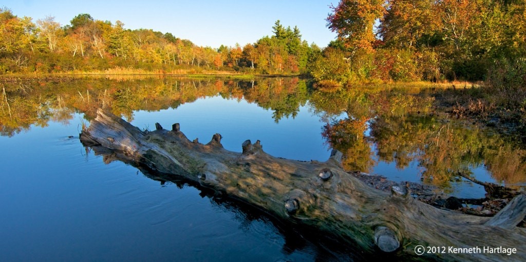
One of the most widely known tracts of land in Pepperell is Pepperell Springs, which, as its name suggests, is a natural spring that provides some of the cleanest drinking water in the area. Some of the previous owners have included companies such as Belmont Springs and Coca-Cola.
In 2004, the town of Pepperell voted unanimously to purchase the 265-acre parcel for permanent conservation protection. Multiple local, state, and federal organizations worked for years to acquire this land that was deemed a protection priority.
“Protecting Pepperell Springs means protecting our drinking water, protecting wildlife and protecting a beautiful piece of our history for future generations to enjoy,” said Senator Kerry. “After a long fight by a lot of people, the protection of Pepperell Springs is now a reality, for the people of Pepperell and all of Massachusetts.”
“This property is one of the highest quality river habitats in the watershed and its protection is extremely good news for an area that has been threatened by development,” Rep. John Olver said. “Protecting the integrity of this area will not only safeguard the drinking water supply for area residents but will benefit the numerous species of plants and animals that live here, maintaining the scenic beauty for generations to come.”
‘In addition to the federal funding, the Town of Pepperell provided $1.5 million for the purchase, an appropriation unanimously approved at Town Meeting in September 2004. $500,000 of that sum will be reimbursed through the Commonwealth of Massachusetts Self Help Grant Program. The remaining $317,000 was raised from individuals and foundations.”
– The Trust for Public Land
Please read more here – Pepperell Springs Protected.
The proposed pipeline would run through Pepperell Springs on the lateral spur heading north from Jewett St. up into New Hampshire. It would run from Pepperell directly into Beaver Brook Association conservation land.
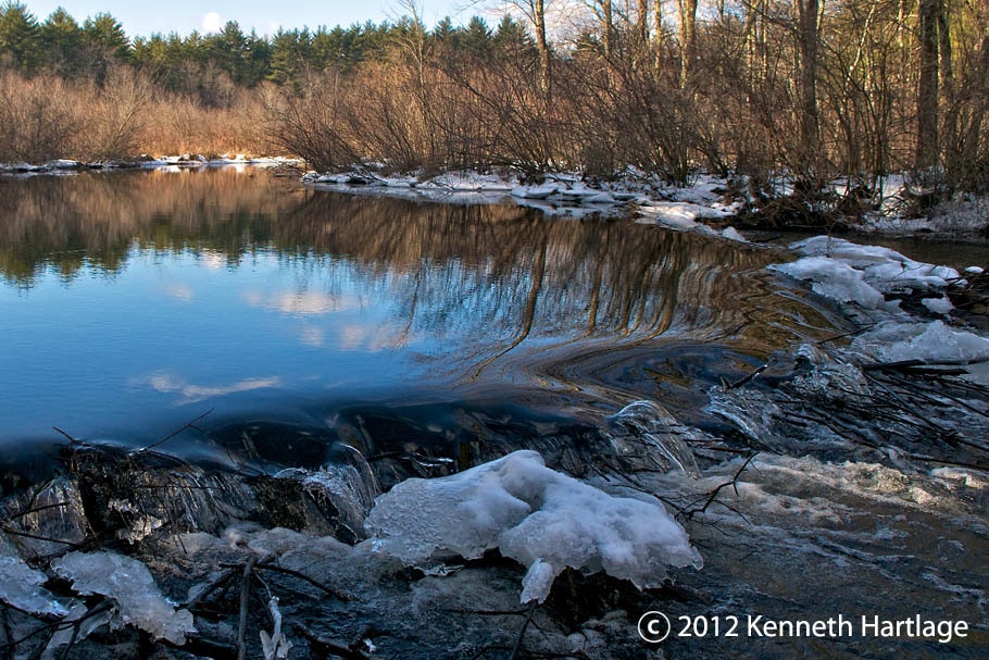
Heald Orchard, located on Heald St. is another area that would be directly impacted. This is an 80-acre town-owned property. Many know the orchard and its pond as a hiking, canoeing, swimming and fishing spot with an abundance of wildlife.
The lateral pipeline into NH would run through the orchard and through another protected water supply. Heald Orchard has a 1,000,000 gallon water tank located where the proposed line would run.
“Designated an Outstanding Resource Waters (ORW) in Massachusetts, the Nissitissit River is a high value aquatic riverine ecosystem with high aesthetic quality and great wildlife habitat. Further, the subbasin has the distinction of being the focus of the Squannacook-Nissitissit Rivers Sanctuary Act (MGL 132A:17) passed in 1975 and intended to protect the ORWs of these two river basins from degradation by new discharges of pollution.”- Nashua River Watershed Association
“Largely because its headwaters tributary streams drain an area that is heavily forested and little developed — namely, the Badger Hill/Spaulding Brook area in Brookline and Mason, New Hampshire and the Townsend State Forest in Massachusetts — the main stem of the Nissitissit River is a cold, clean, well-oxygenated stream that is frequently cited as prime habitat for native brook trout and five listed rare species. Important habitat areas include: Townsend State Forest, Gulf Brook, Heald Pond, Townsend Hill, Nissitissit Hills, Kimball Farm, and Bancroft Brook Headwaters. Sucker Brook is a cold-water fishery containing native Eastern Brook Trout and is stocked with trout as is Gulf Brook. Mine Brook is also a cold-water fishery. Due to conservation efforts, nearly 50% of the entire length of the Nissitissit River has a 300 foot vegetated buffer strip. There is particularly strong land protection focus in Brookline, NH. Indeed, given its high quality there is consideration of designating New Hampshire Scenic Status to the Nissitissit River.” MA Fish Finder.com The proposed pipeline would cross under the Nissitissit River.
Many Residents of Pepperell and neighboring town remember the days when the Nashua River ran a different color on any given day, depending on what was being dumped into it. “The Nashua River was heavily used for industry during the colonial period and the early United States. During the late 18th century and early 19th century, the heavy concentration of paper mills and the use of dyes near Fitchburg resulted in pollution that notoriously turned the river various colors downstream from the factories.
In the mid-1960s, Marion Stoddart started a campaign to restore the Nashua River and its tributaries. She built coalitions with labor leaders and business leaders, in particular the paper companies who were the worst polluters of the river. With federal help, eight treatment plants were built or upgraded along the river. A broad conservation buffer was created along about half the river and its two main tributaries. By the early-1990s, most of the industry was still located along the river, but many parts of the river were once again safe for swimming. Her work is the subject of a 30-minute documentary movie.[2]
Recovery has sparked recreational use of the river at places like Mine Falls Park in Nashua.
The largely volunteer Nashua River Watershed Association, based in Groton, Massachusetts, oversees the condition of the river.[3] -“
In addition to crossing under the Nashua River itself, the proposed pipeline would cross through the entire top half of the Nashua River Watershed.
Town of Pepperell
Click map to enlarge
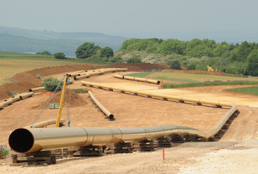
below: Gas pipeline being laid out
Click image to enlarge

The Old 'Pepperell Spring House'
All rights reserved. All content on this site property of Nashoba Conservation Trust.
Do not copy or reproduce in any form for any reason without written permission from Nashoba Conservation Trust.