
Nashoba
Conservation
Trust

Nashoba
Conservation
Trust
Heald Orchard
Walk along the grassy lanes through the orchard and listen to the song of Baltimore Orioles, Blue-winged Warblers, and Bluebirds. Many grassland birds can be found in the fields around the orchard. Search the frog pond for turtles and follow the path down the hill and
through a hemlock forest to a sandy shoreline area of Heald Pond. Here there are great views of the rocky cliff on the western edge of the pond.
Land Protection History
This 80-acre property was once a working apple orchard. The Town of Pepperell purchased the orchard in 1979 for water supply protection, fruit production and open space. The Conservation Commission leased the land for commercial fruit production until 1999 then the highly-competitive agricultural markets for apples made it difficult to find a farmer to lease the orchard. A new land Management Plan was completed in 2008 with the goals of creating diverse habitats for wildlife and additional passive recreational uses.
Trail Description
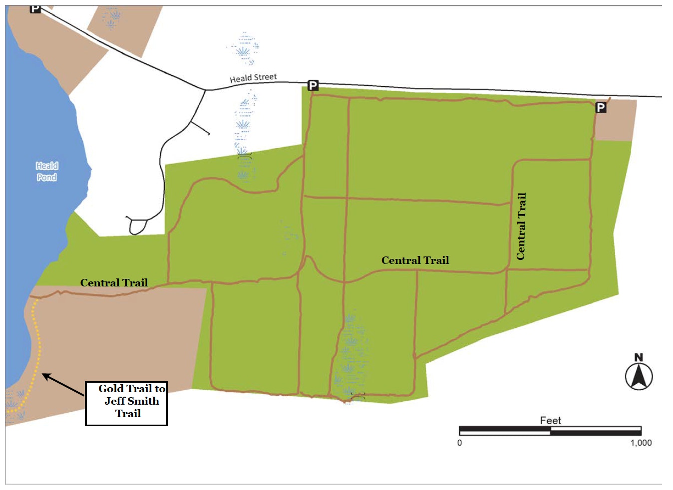
The Orchard has many trails and paths. This trail description covers a main trail through the center of the orchard, known as the Central Trail. The trail is unmarked but can be followed with the map in hand. From the parking area, walk past the gate and turn right to follow the path along the edge of trees leading to the main orchard. At the “T” junction, turn left and take the second right onto a very wide trail bordering a “savannah” field. This field was designed, in part, to attract kestrels and other birds of prey. After the field, the trail dips and then ascends to a flat rocky area offering great views of the orchard and another field managed for field nesting birds. Heading west across the field the trail descends into a forest to the shoreline of Heald Pond. Upon reaching Heald Pond there is an option to follow the Gold Trail to the western side of the pond, connecting to the Jeff smith Trail. See the Heald Pond map for more details. Please take note: the Heald Orchard fields are managed for ground nesting birds in Spring and Summer. Please stay to the mowed paths.
Trail Mileage
From the parking area the Central Trail to Heald Pond is .71 miles
Directions
From Pepperell Town Hall, head north on Park Street and take the first left onto Heald St. Follow Heald St. for 1.5 miles; the dirt parking area is on the left next to the orchard. The GPS coordinates for the parking area are: Latitude 42.67099; Longitude -71.62231.
Click map to enlarge
All rights reserved. All content on this site property of Nashoba Conservation Trust.
Do not copy or reproduce in any form for any reason without written permission from Nashoba Conservation Trust.