
Nashoba
Conservation
Trust

Nashoba
Conservation
Trust
Stewart Brook
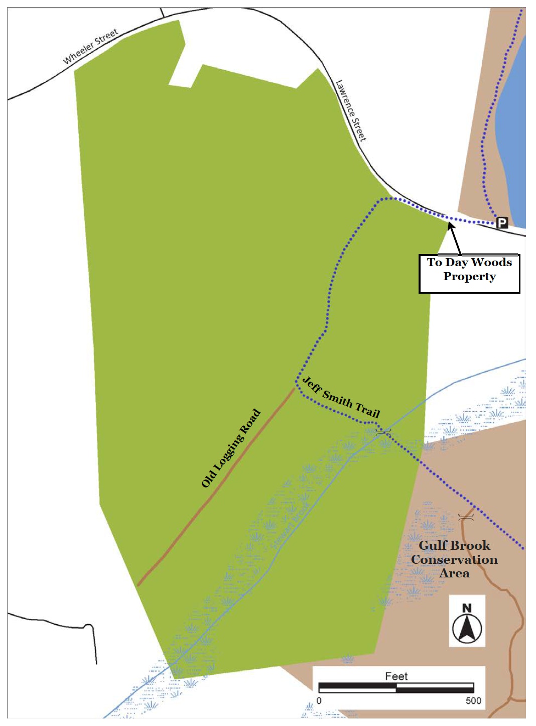
Stewart Brook flows through a large esker creating scenic views of the brook and surrounding hemlock forest. The brook heads northeast where it merges with Gulf Brook and continues on to a large beaver pond and shrub wetland. The dense and moist hemlock forest is great habitat for porcupines, fisher, and pileated woodpeckers. There are several vernal pools where spotted salamanders and wood frogs breed. The glacial history of the property is apparent from scattered large boulders and the 50-foot esker running parallel to the brook. Stewart Brook abuts
the Gulf Brook Conservation Area.
Land Protection History
The Pepperell Conservation Commission acquired the 42-acre property from the Rich Tree Farms and Forestry Company in 1984 to protect the Stewart Brook-Gulf Brook watershed and the aquifer recharge areas of the town’s Bemis Road well. The Commission felt it was important to preserve the gravel esker on the property to filter and purify water recharging the aquifer. State Self-Help grant funds enabled the town to purchase the land.
Trail Description
The Jeff Smith trail follows an old logging road southwest into a rich hemlock forest full of moss and lichens. At .13 miles, the trail divides: to the right the logging road continues another .2 miles to a vernal pool and a large glacial erratic. Alternately, turn left and follow the Jeff Smith Trail to Stewart Brook. Crossing the brook connects to the Gulf Brook Conservation
Trail Mileage
From the street trail entrance to the Stewart Brook crossing over to the Gulf Brook Conservation Area is .28 miles. From the street trail entrance to the vernal pool at the end of the logging road is .33 miles.
Directions
From Pepperell Town Hall, follow Park St. 1 mile north. Bear left onto Oak Hill St and go 1.3 miles and turn right onto Lawrence St. Continue another 1.3 miles and look for NCT sign for Day Property on right. Park and head up Lawrence Street to Stewart Brook sign on left. The GPS coordinates for the parking area are: Latitude 42.69637; Latitude -71.63613.
Click map to enlarge
All rights reserved. All content on this site property of Nashoba Conservation Trust.
Do not copy or reproduce in any form for any reason without written permission from Nashoba Conservation Trust.