
Nashoba
Conservation
Trust

Nashoba
Conservation
Trust
Town Forest
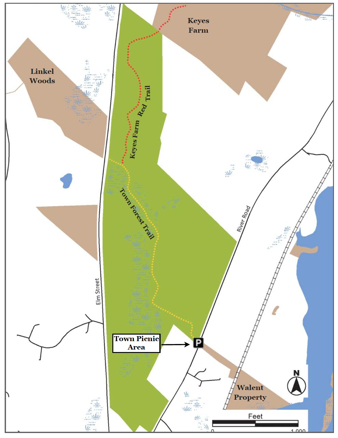
The Town Forest comprises 90 acres of white pine forest with extensive wetlands throughout. It’s home to deer, a nesting pair of red-tailed hawks and dozens of other bird species during summer breeding season. Importantly, the Town Forest connects to three other conservation areas: the West-side Trail, Linkel Woods and Keyes Farm.
Land Protection History
In 1925, the Town Forest Committee (a Committee that was formed in response to the Board of Selectmen's 1922 request to establish a Town Forest) purchased over 100 acres (90 acres on River Road and an additional acreage off of Jewett Street) for $500 for the "Purpose of "Reforestation". The Commonwealth provided 5,000 white pine seedlings to any community who established a Town Forest of 100 acres or more. The white pine seedlings were planted by local groups including scouts and school children.
Trail Description
There are two starting points for the Town Forest Trail: Elm Street and the Town Picnic Area. This description originates at the Town Picnic Area: The trail begins on the north side of the Picnic Area, and is marked with gold trail markers. At .05 miles, cross under the power lines, and follow the trail markers to the fire road; the Town Forest trail follows the fire road another .50 miles to the Elm Street entrance.
Trail Mileage
From either trail head the Town Forest trail is .51 miles. From the Picnic Area the Town Forest trail intersects with the Keyes Farm trail, designated by red trail markers, at .40 miles. From there it is another .50 miles to the Keyes Farm entrance on Elm Street.
Directions
To Elm St. parking: From Pepperell Town Hall take Elm Street. Follow Elm Street for 1.2 miles until you see the sign for Altali’s. Parking is along Elm St. just past the sign. The trail head is about 100 feet north of the Altali sign on the opposite side of the road.. The GPS coordinates for the street parking area are: Latitude 42.64944; Longitude -71.59731. To Town
Picnic Area parking
From Pepperell Town Hall, go East .4 miles on Main St. to the rotary. Bear right onto Rte. 111 South. At 2.2 miles turn right into the Picnic Area parking lot.. The GPS coordinates for the Town Picnic Area are Latitude 42.64388; Longitude -71.59333.
Click map to enlarge
All rights reserved. All content on this site property of Nashoba Conservation Trust.
Do not copy or reproduce in any form for any reason without written permission from Nashoba Conservation Trust.