
Nashoba
Conservation
Trust

Walent Properties / Westside Trail
The Walent property and West Side Trail are hidden gems in the Pepperell Pond area of the Nashua River. Walk along the Westside Trail, which runs through the property, in early spring to see Common and Hooded Mergansers, and Red-winged Blackbirds. This area of the river is a migratory stopover for waterfowl heading north in spring. A bench at the northern tip of the trail overlooks the river.
Land Protection History
NCT worked with Department of Environmental Management (DEM) to protect the Walent property in 2002. NCT contributed $20,000 toward the purchase of the 46-acre parcel making it possible for DEM to acquire the land from the Walent family. The Pepperell Conservation
Commission purchased the one-mile rail bed in June 2002 with funding from the Massachusetts Division of Conservation Services under the former Self -Help Program. The Commission decided not to pave the trail and instead kept it in its rustic condition to provide a more natural
experience for hiking, fishing and wildlife viewing along the river. The history of the old railroad bed on the west side of the Nashua River in Pepperell is covered by local historian and author, Ronald Karr, in his book entitled “Lost Railroads of New England”.
Trail Description
There are two options from the centrally located Walent parking area: (1) Head into the woods along the banks of the river and follow the white triangle signs north to the small peninsula, which offers wide, open views of Pepperell Pond and the islands. (2) Head south along the old railway bed, passing through two splendid oxbow areas of the Nashua River; the south-bound trail ends at Rte 119. Both the north and south-bound segments of the Westside Trail provide opportunities to spot Wood Ducks, Common and Hooded Mergansers, otters and owls.
Trail Mileage
From the Walent parking area, the northbound segment of the Westside Trail is .5 miles; the southbound segment is 1 mile.
Directions
To the Pepperell Pond parking area: From Pepperell Town Hall, go East .4 miles on Main St. to the rotary. Bear right onto Rte. 111 South. At 2.1 miles turn left on to an unmarked dirt road and follow it to the parking area. To the Walent parking area: From Pepperell Town Hall, go East .4 miles on Main St. to the rotary. Bear right onto Rte. 111 South. At 2.2 miles turn left on to an unmarked dirt road. Follow the dirt road past the house on the right and park in the field. The GPS coordinates for the Pepperell Pond parking area are Latitude 42.64666; Longitude -71.58916. The GPS coordinates for the Walent parking area are: Latitude 42.64190; Longitude -71.59108.
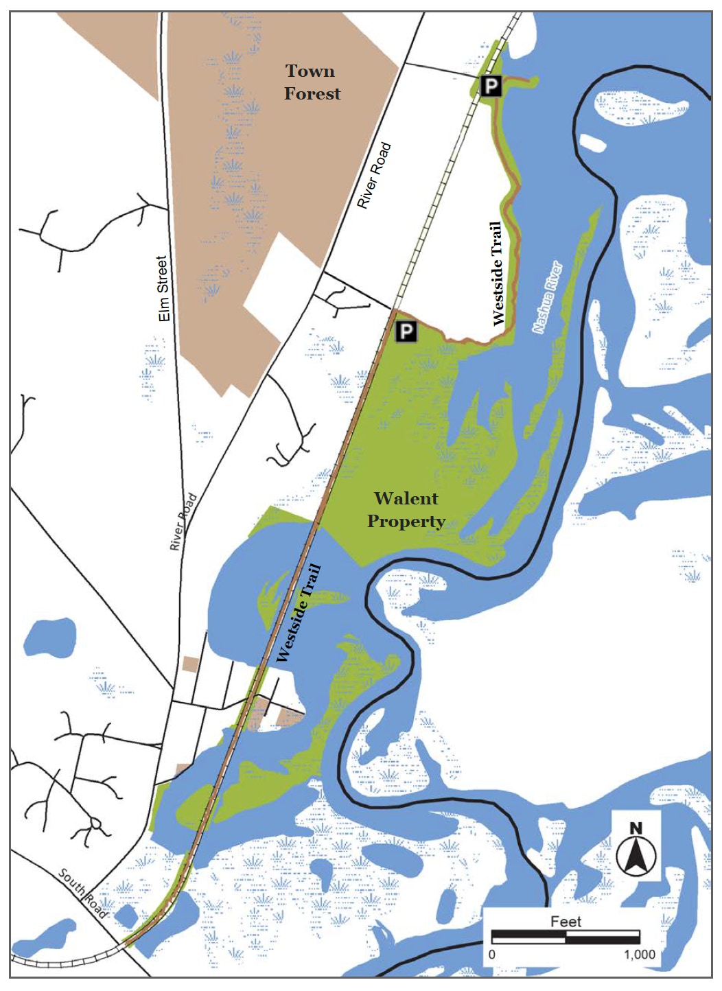
Click map to enlarge
All rights reserved
All content on this site property of Nashoba Conservation Trust. Do not copy or reproduce in any form for any reason without written permission from Nashoba Conservation Trust.